Road Canyon
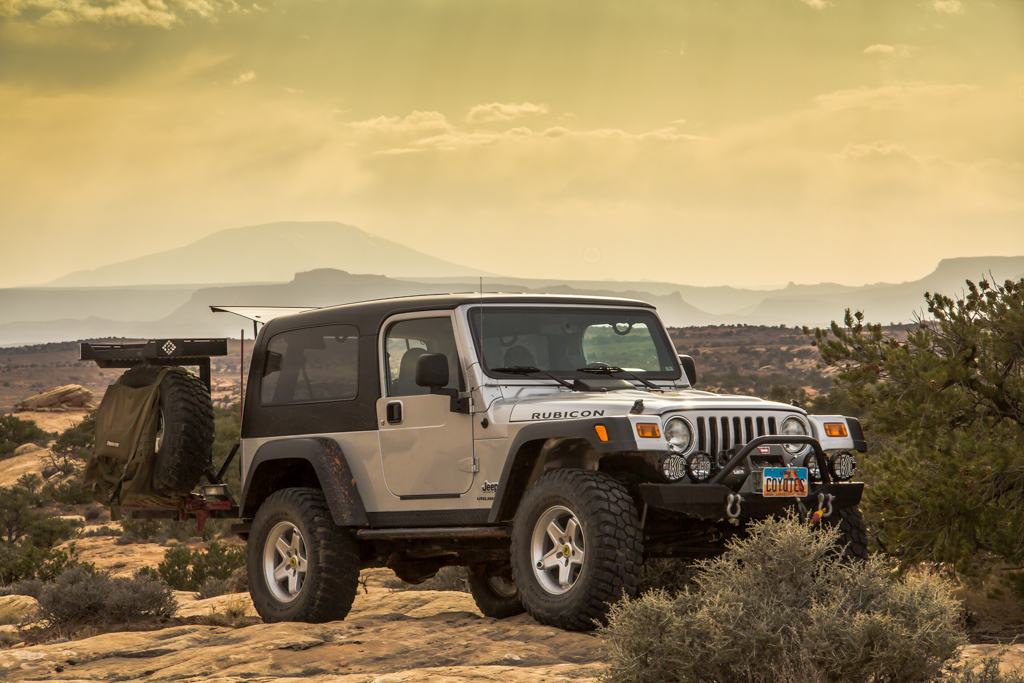
On Thursday the 14th of March, I left work a bit early, climbed in my ’06 Jeep LJ and made the six hour or so drive south from my home in Davis county, Utah, to the environs of Cedar Mesa in SE Utah’s San Juan county. After the long drive, I pulled off the highway onto Cigarette springs road and proceeded down the dirt track to where it dead ends at the head of a Road canyon tributary. There I unfolded my cot and unrolled my sleeping bag. Gotta love only 2 minutes to setup camp!
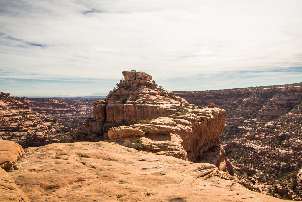
Mesa Top Site
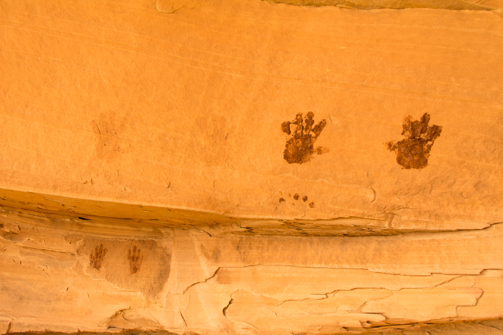
There was still an hour of daylight left and I felt like taking a walk after the 6 hour drive to get here. So I started off across the mesa, just stretching my legs. About 20 minutes later I stumbled across a small mesa top site. Potsherds, flint chips, literal archaeology scattered on the ground. A few yards from the two stones that had alerted me to the sites was a more profuse scattering of building cobbles, all overgrown with sage and cactus. And a few yards beyond that, this:
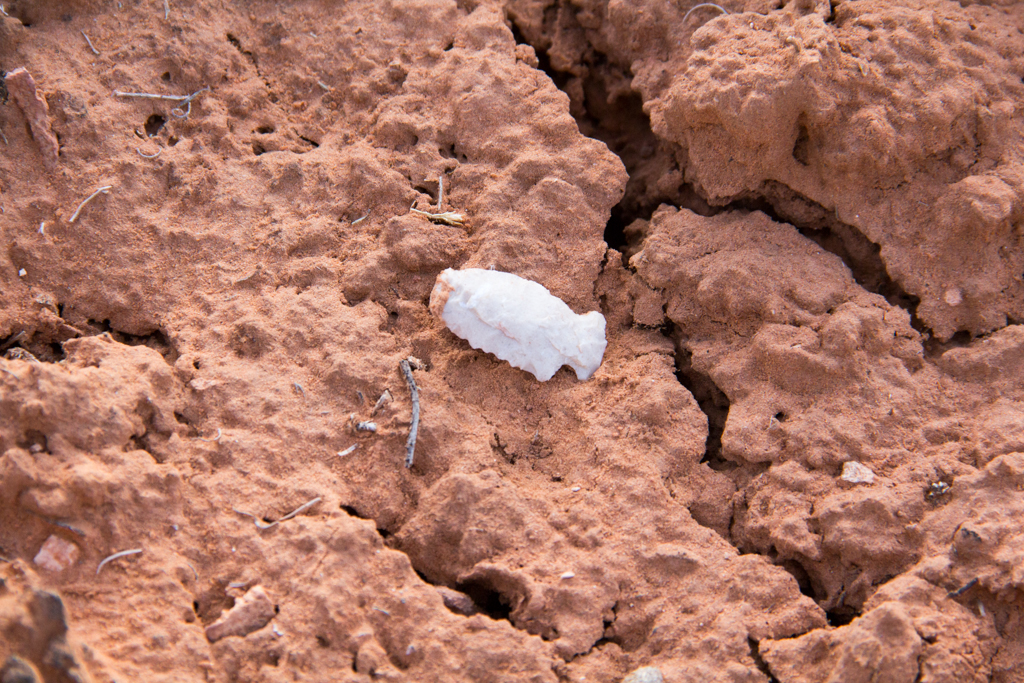
Nothing particularly unusual about stumbling across a site like this on Cedar Mesa. And certainly nothing special about this particular site. But after a long winter up north, being able to take a short walk and find it sure felt awful dang good!
Darkness was falling by the time I arrived back at camp. Feeling lackadaisical, I made a small fire and quickly roasted a couple brats over the coals for my dinner. Then it was early to bed, for my first night under the open stars in far too long. The night was clear, temps got down to about 35 and a stiff breeze came up around midnight. Just enough breeze to have me burrowing deep into my bag, but not enough to ruin my sleep.
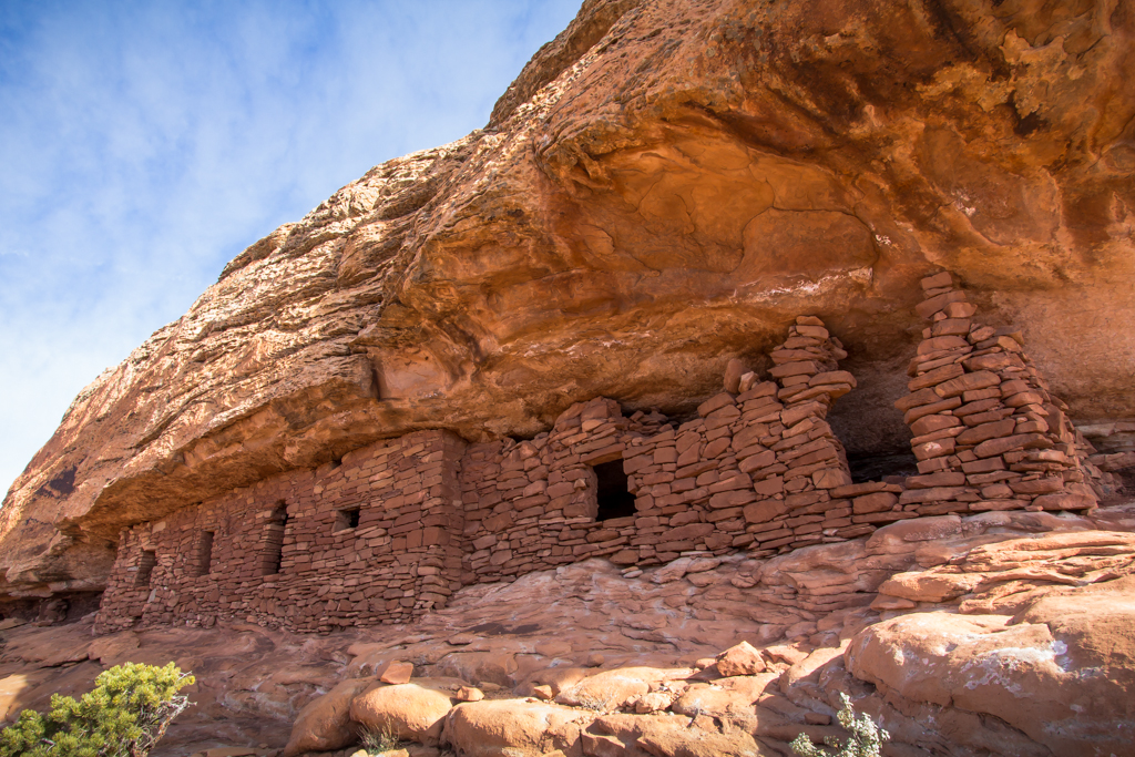
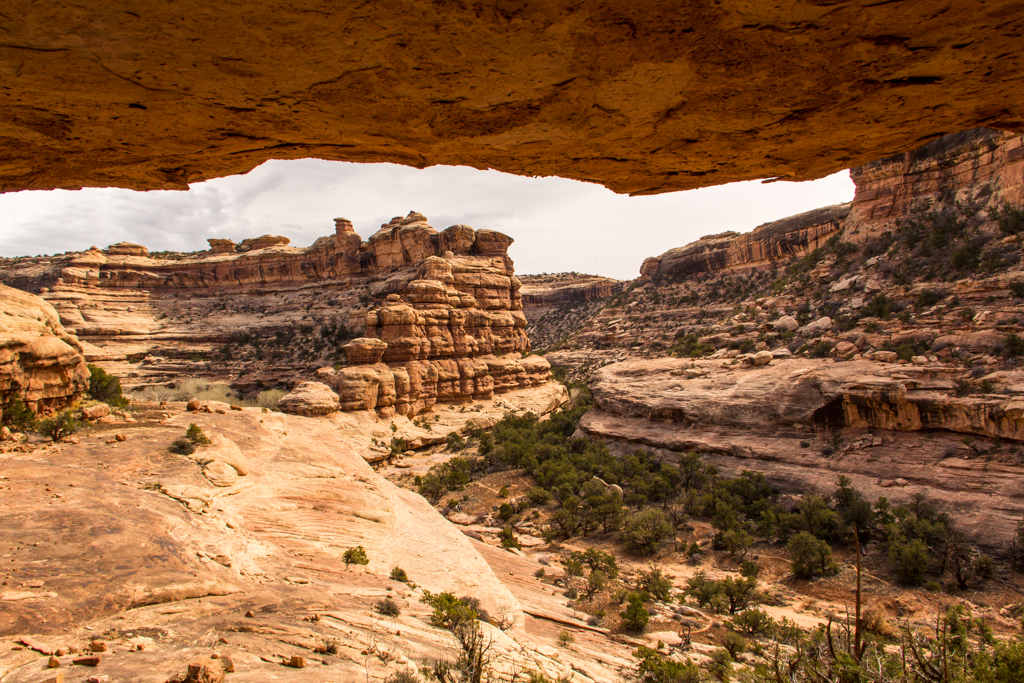
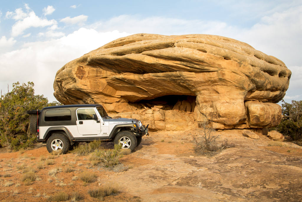
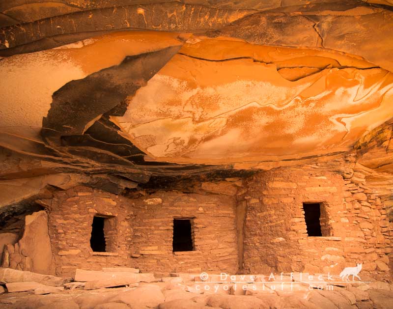
The Citadel
Up at dawn, I lingered over a second cup of coffee and smoked a cigar watching the light come on and the colors fill in. Then after stowing my gear in the Jeep, I drove a few miles west and parked near the rim of Road canyon. After a long cold winter, walking the rim of Road Canyon in shirtsleeves on a fine March morning was just about as good as it gets!
I took the short hike to visit the Anaszi ruin known as “The Citadel”. So named for its fortress like protective access. The main ruins are situated around a large stone knob that can only be reached via a long natural stone causeway. Evidence of fiercely effective blockading walls across the causeway is still evident today, 700 years since they were last guarded by the people who lived here.
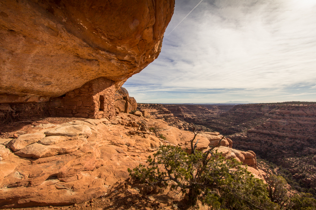
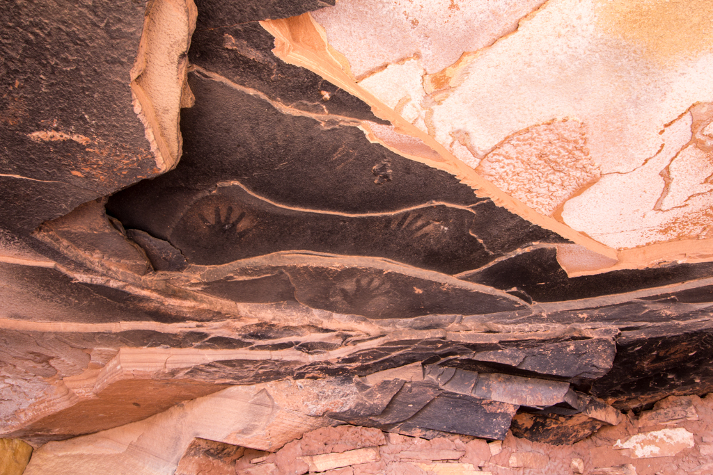
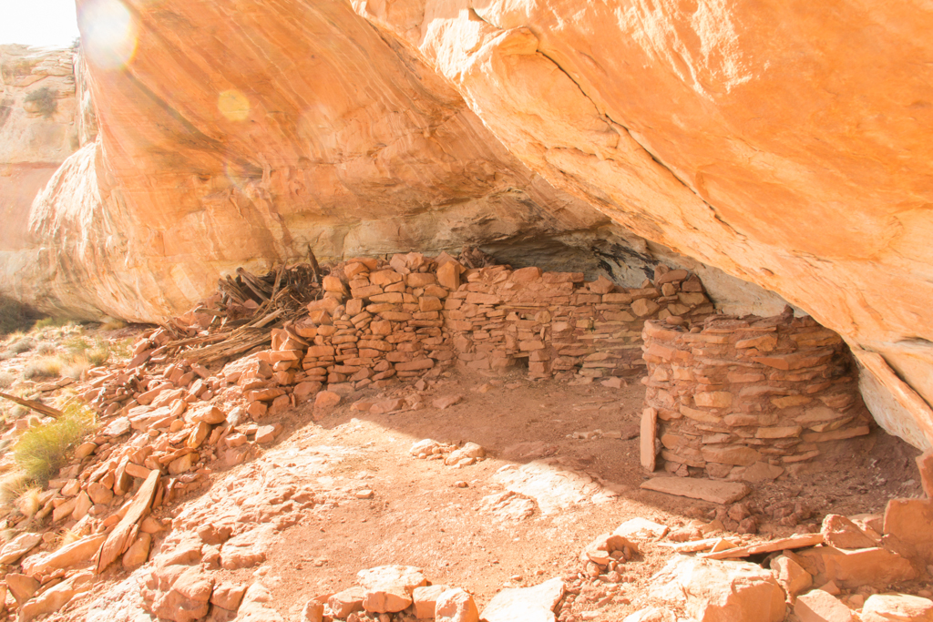
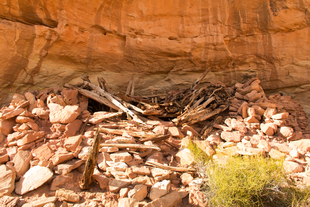
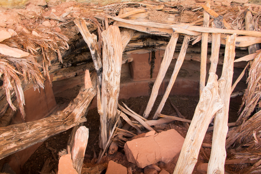
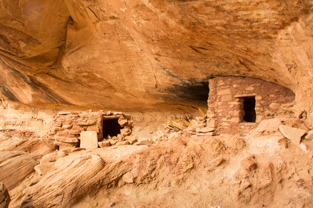
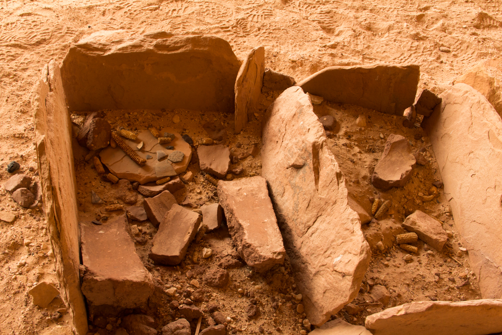
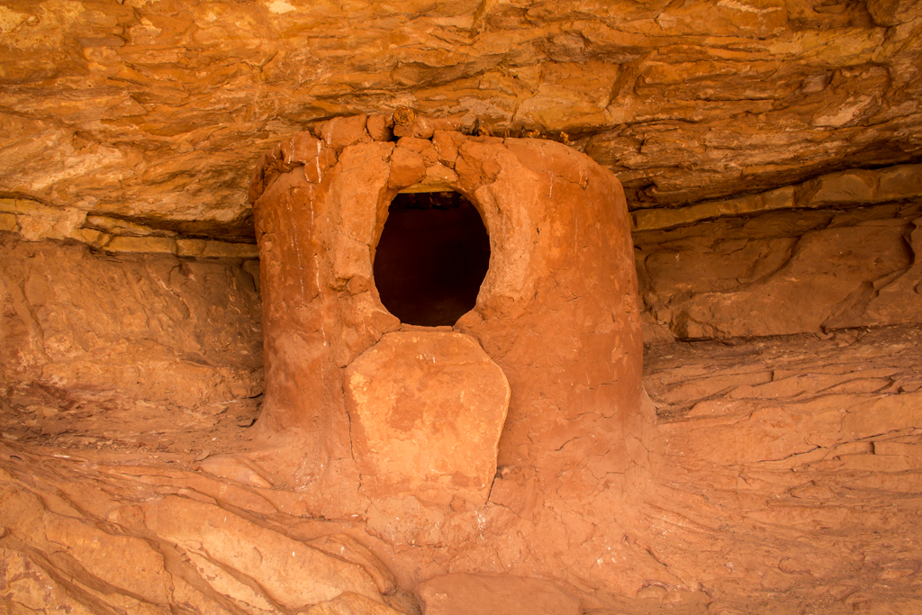
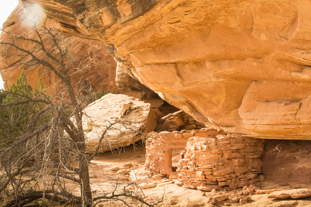
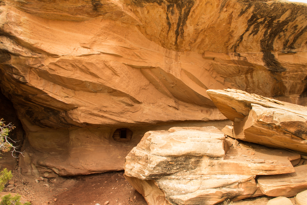
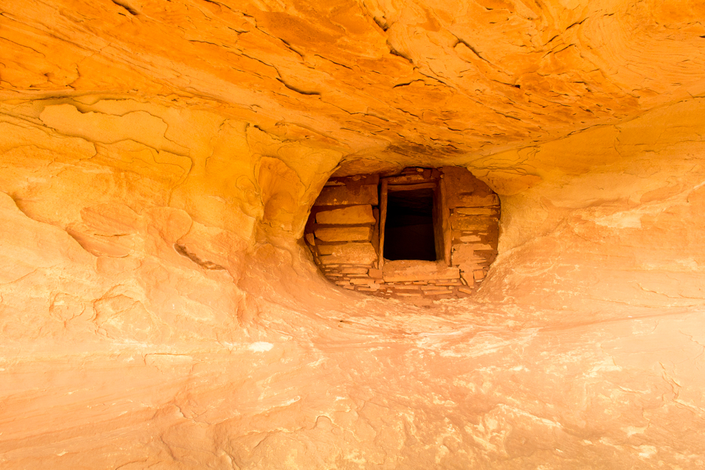
Fallen Roof Ruins
Returning to the Jeep, I drove up the dirt track a short distance to another trail head for my second hike of the day. It was to be a fairly short hike, to visit the famous Fallen Roof site.
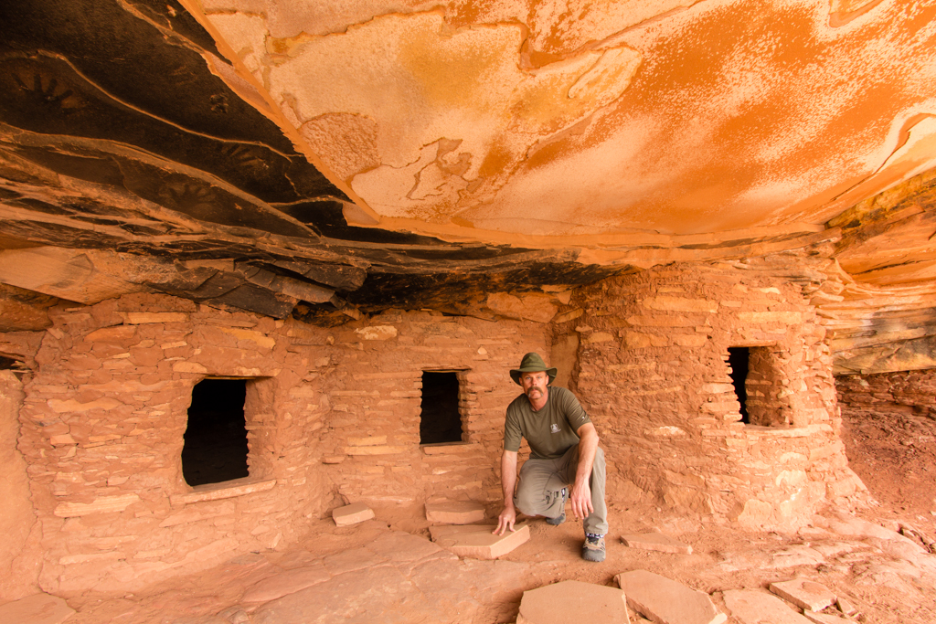
And how about this one, see the small door to the left of the main door? What would you make of that? A cliff dwelling with a doggy door? An interesting and unusual feature to be sure.
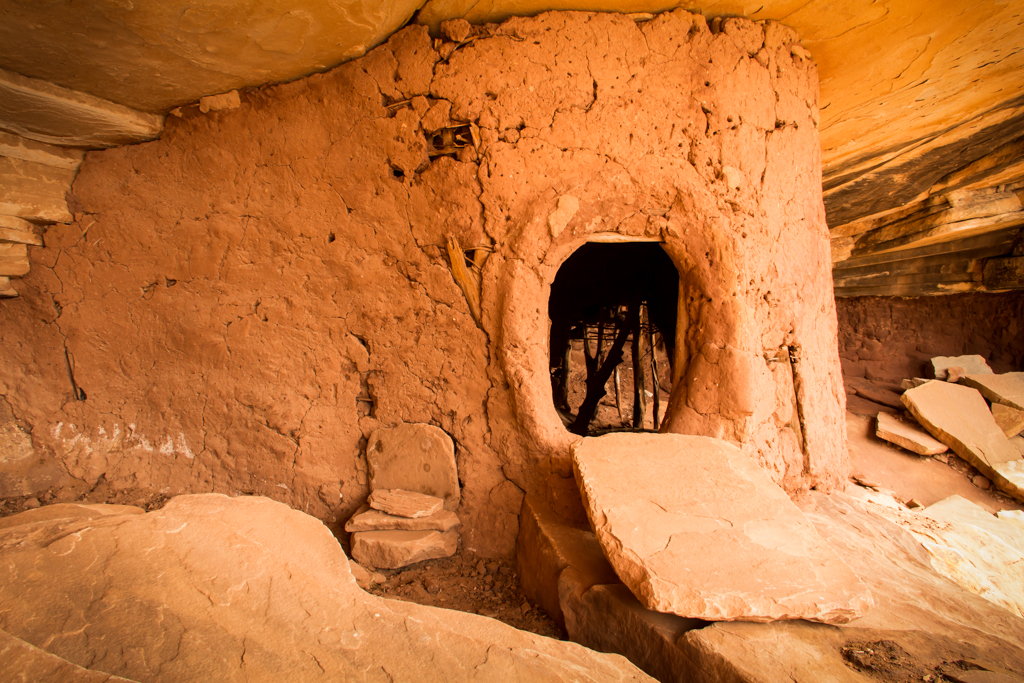
Lime Canyon
After Fallen Roof, it was back to the Jeep again. I decided to drive over to the Lime canyon and poke around there for a bit. The connecting road between Cigarette Springs rd. and the Lime Canyon track showed evidence of little, or even no use yet this spring, with a couple of rough spots and wash crossings to keep it interesting.
Upon arriving at the head of Lime canyon, I made the very short walk to visit the Lime Canyon Tower ruins.
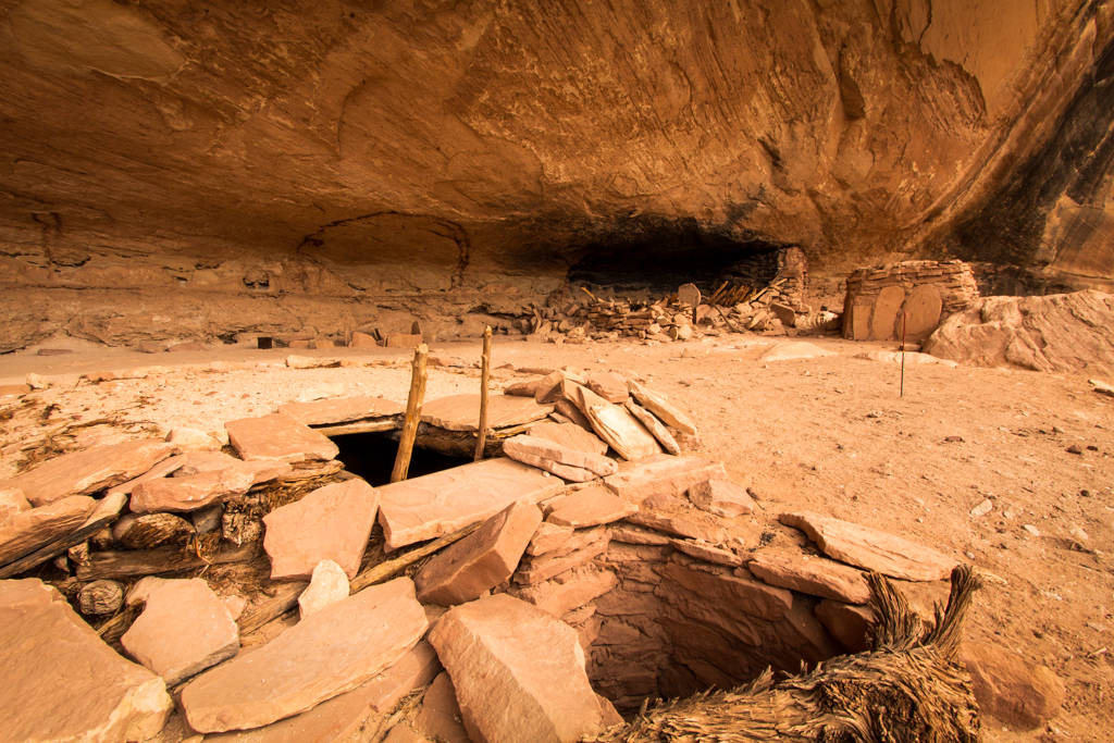
I had intentions of spending more time exploring by Jeep this afternoon, but, one thing led to another, and next thing I knew, I was off on a five mile bushwhack on foot down into and back out of Lime canyon. Found some awesome ruins!
Judging by the lack of foot prints, this was one of the least visited ruins I’d see for the entire trip. The kiva was even fairly intact and preserved, but without any of the “stabilization/sanitation” of the more “perfect” kivas at other sites.
Back at the Jeep once again, my feet were KILLING me. I took off my shoes and socks to assess the damage and was shocked at just how bad they looked. Multiple toe blisters on both feet. Heel blisters on both feet. A blister on the ball of my right foot. A huge blister on the side of my foot where I’ve never seen one before. I guess that will teach me to wear new, unproven shoes for my first good walk of the year…
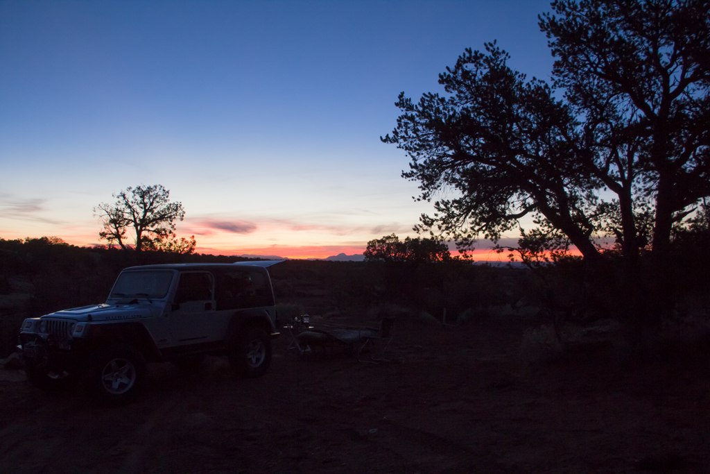
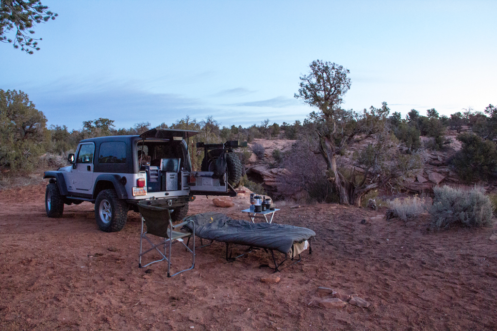
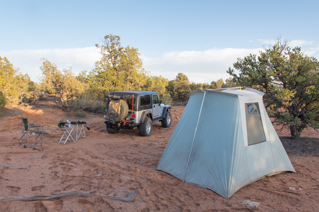
Anyway… I was definitely done walking for the day… So, I drove back to the highway and crossed over onto the dirt again and drove to the vicinity Slickhorn canyon to find myself a secluded spot back in the forest to setup my tent.
My feet were hurting something terrible. I was in a GREAT mood though. Feet be damned! I was on Cedar Mesa. It wasn’t snowing! I had a whole nuther day ahead to enjoy it! And… I also had a tremendous looking Mahi Mahi steak which I broiled, accompanied by buttered asparagus and a nicely stiff buttered sourdough roll. Dang that was good!
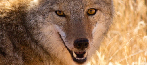
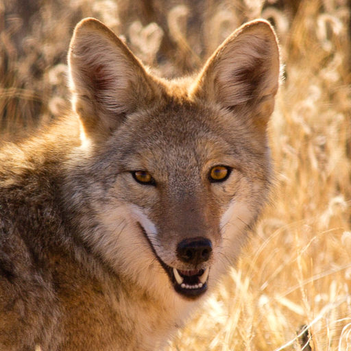
After dinner I sipped some Rendezvous Rye and exchanged insults with a vocal coyote until it felt like bed time. I had that coyote so worked up he sounded like he was popping veins in his forehead screaming back at me. Good times!
Here’s camp for Fri. and Sat. night
Slickhorn Canyon and Perfect Kiva
Up before light on Saturday, but slow to get moving. The feet were just too painful. I sat around eating breakfast and drinking coffee for awhile, then did what I could to lance the blisters, wash, dry and tape up my poor feet. Then I put on my “other” new boots and drove over the the Slickhorn trail head and started putting one foot in front of the other on down the trail…
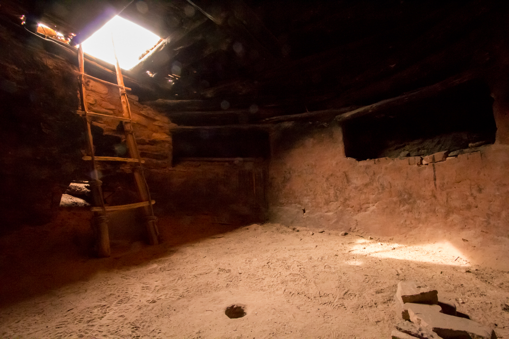
Beautiful morning! The main attraction in this fork of Slickhorn is the Perfect Kiva site. Pretty neat.
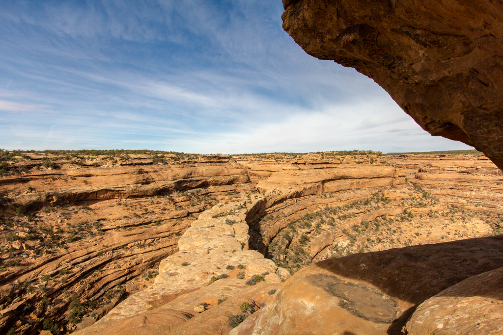
From there it was basically just a nice spring canyon hike. I spotted a couple granaries near the confluence of the next fork of the canyon, of which this one was far the nicer.
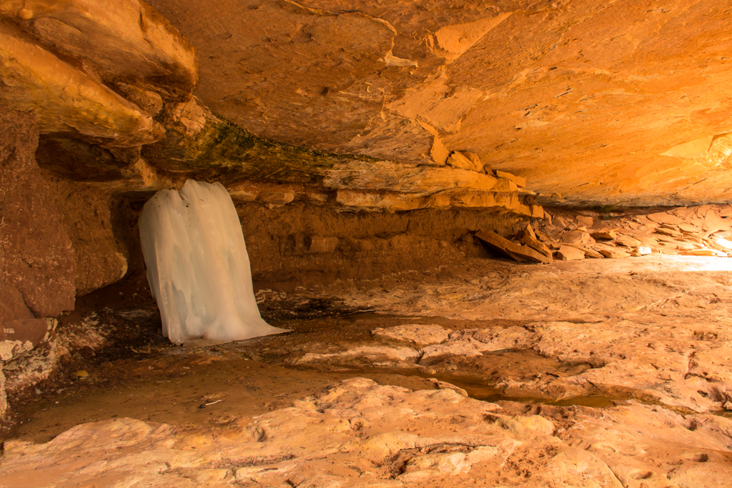
From there I turned up the second fork and started heading back. Encountered several boulder piles and dry falls that required a bit of route finding to get around, but nothing too rough. There was still a few patches of snow in spots and a bit of ice in the bottom, but I was surprised to see this ice fall under a ledge on my way up.
I eventually got back to the road and back to the Jeep.
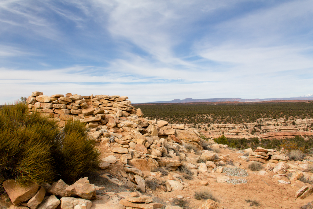
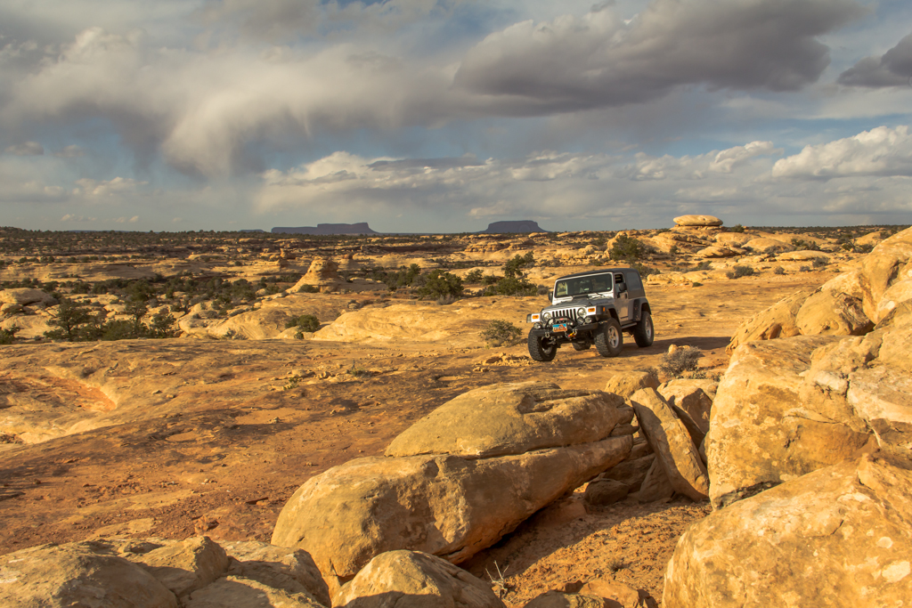
Slickhorn Pasture
It was still pretty early, so I just climbed into the Jeep, lit a nice Padron ’64 and went for a long scenic drive, taking the rough track all the way out past Hat Rock to where the track ended nearly to Slickhorn Pasture. After leaving the relatively smooth dirt of the main mesa top, I saw nobody out there at all, and it was gorgeous!
Another “near road” ruin, which was definitely the least visited of any I saw on this trip. There was no trail at all and no footprints anywhere to be seen.
I eventually drove back to camp for a big last night celebratory dinner. A thick rib eye steak, with new red potatoes quartered and sautéed in garlic and butter. Afterward, I sipped Rendezvous Rye and smoked my Padron ’64 and tried to get my coyote from the night before to talk to me again but he wasn’t answering. I lingered long over my small fire and my whiskey and cigar, reflecting on the kind of things one reflects on around a lonely campfire, finally going to bed feeling a profound sense of wellness that so often comes at times like these.
Point Lookout
Slept in until almost 7:00 on Sunday morning and took my time with morning preparations and packing up camp. Then, just because I felt like it, I took the bumpy drive all the way out to Point Lookout, before retracing my path back to the highway and heading for home.
A very nice trip!
– DAA
Amazing stuff. I have got to make one of those trips.
You definitely should!
Amazing story and pictures Dave. You never cease to entertain. Readers can easily find themselves ensconced in your story and imagine themselves along for the ride.