
Lunar Crater
So the general theme of this trip was “stuff I’ve meant to check out for a long time”. I have traveled through this area and driven by this stuff a few times and always thought “some day I ought to stop and look at that”. Well, this time, I did!
The area of interest, is a lonely chunk of Nevada mining history, west and south of Ely.
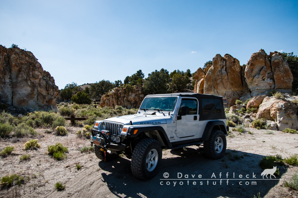
I was able to get rolling about noontime on Thursday the 7th, heading west on I-80 to Wendover, then south on 93 to Ely, where I topped off the fuel, including two jerry cans, for a total of 42 gallons on board. I’d not see another gas station until returning to Ely a few days and 400 miles later.
From there I headed SW on the road towards Tonapah. For camp this first night, I decided to check out Lunar Crater and find a place to sleep near there.
Lunar Crater is one of those places I have driven by the turn off a bunch of times and always said “one of these days I’m going to go check that out”. So, I finally did!
After leaving the highway, I first arrived at Lunar lake, a dry lake bed. Who can resist driving across and expansive dry lake bed?
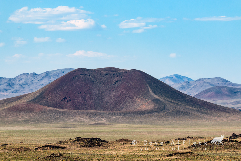
Next up was Lunar crater itself. Although it looks like one, it’s not an impact crater, but a geologic feature known as a “maar”. Created by explosive volcanic eruptions close to ground level. The crater is about 400 acres in size and 430 feet deep. The site was used by NASA to train astronauts for the Apollo moon missions. Also nearby is Easy Chair crater and numerous other smaller volcanic formations.
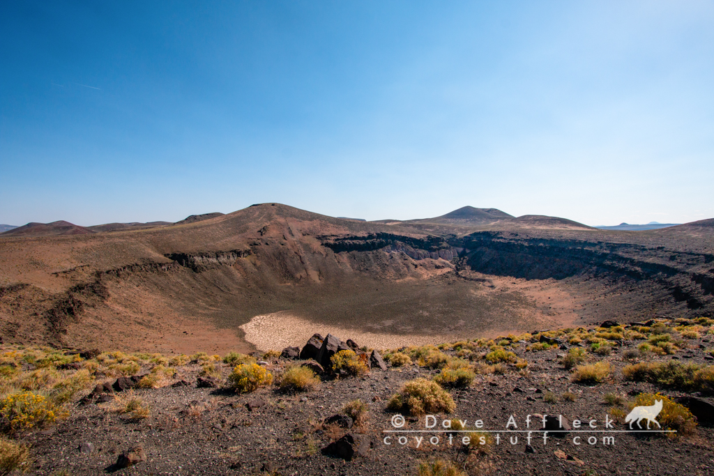
I actually think Easy Chair crater, just across the valley, is more interesting to look at.
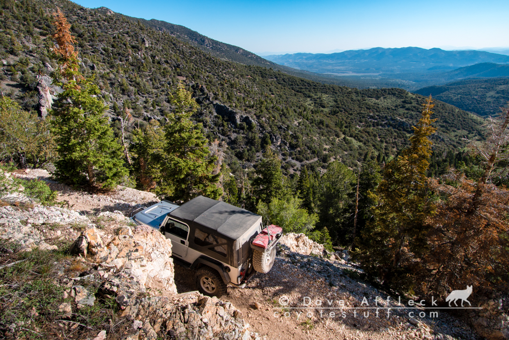
The wind was blowing pretty hard and the area right around the craters was totally exposed so I headed west a few miles to the nearest line of hills and took a side road up into a small fold with some wind protection that took me up to what must have been a small time mining operation at one time. After some dinner I set out my sleeping bag on my cot under the stars for the night.
I have just very recently started trying to get some nightscape shots. I’m taking the lazy approach, just setting up my camera on a timer and going to bed and hoping something turns out. I kinda dig some of the pics I’m getting this way though. Here is me asleep on my cot in front of my Jeep, with the milky way above.
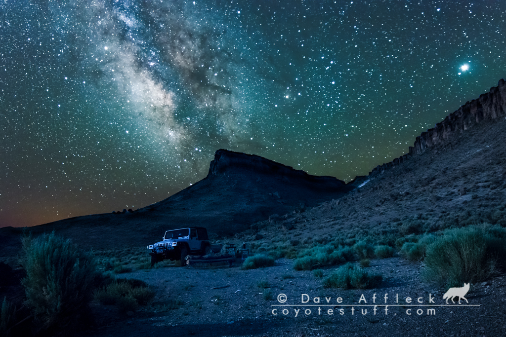
And a short timelapse video from all the shots the camera took that night while I slept. Not sure what is up with the funky purple though!
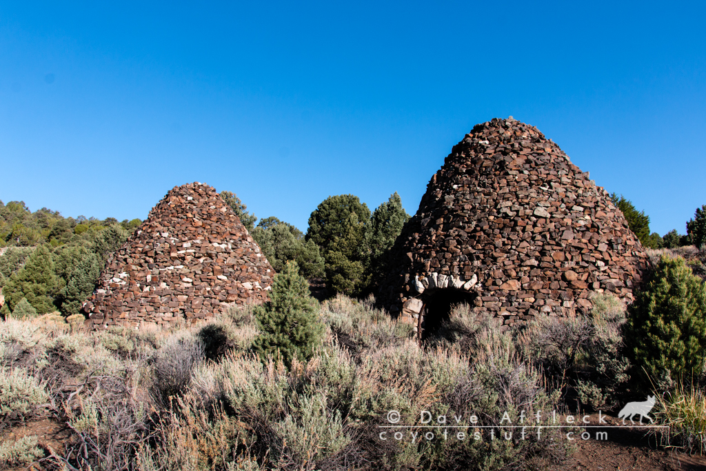
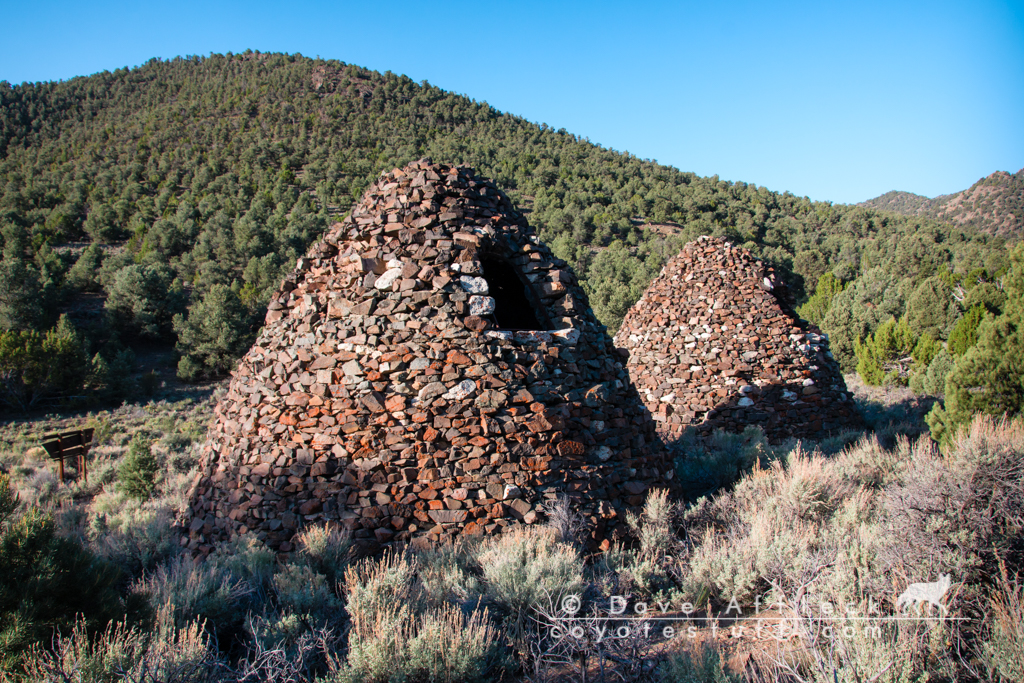
Tybo
I was up and rolling again early the next morning. Heading back to the highway to head southwest again for a few miles before leaving pavement and heading up the east side of the Hot Creek range. I’d not see pavement again for nearly 300 miles, yippee!
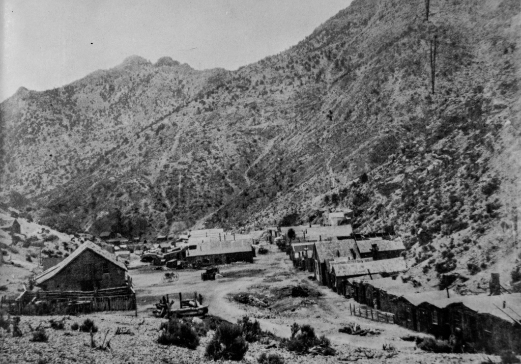
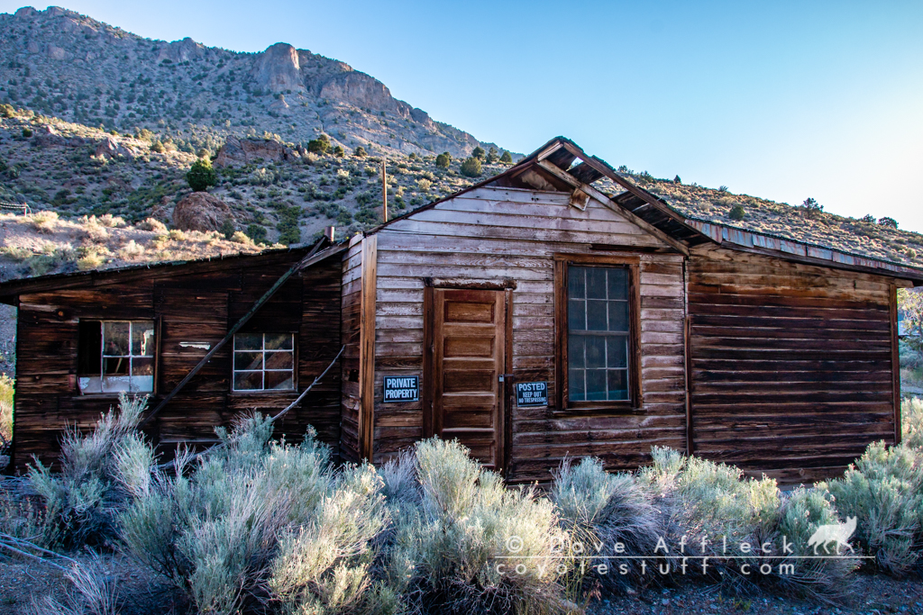
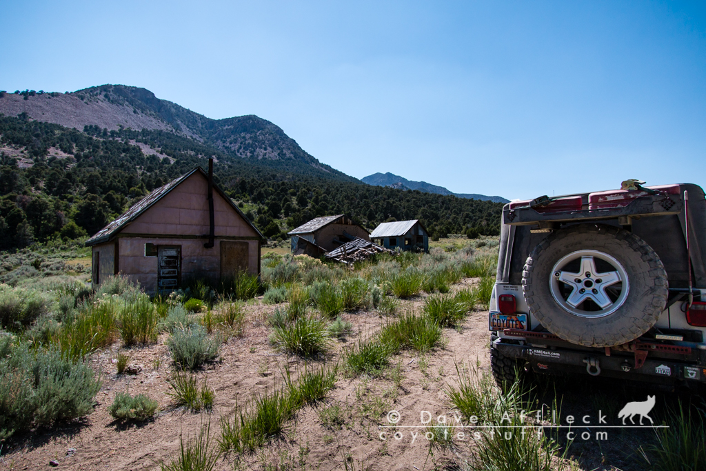
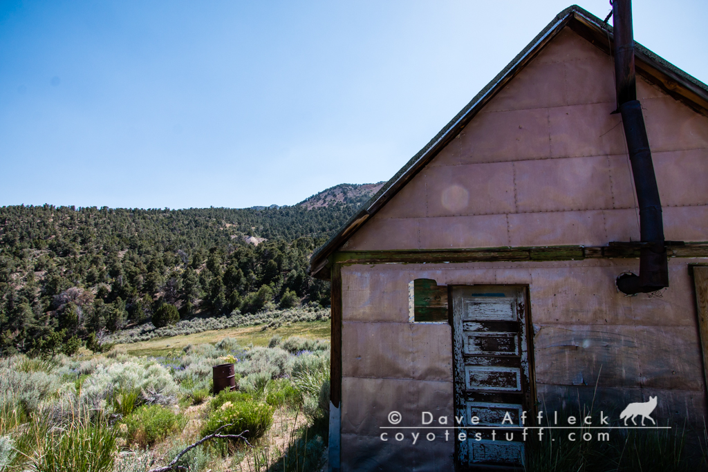
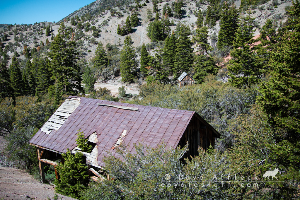
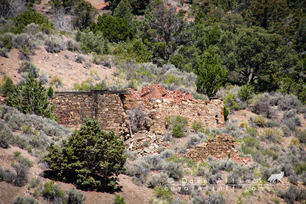
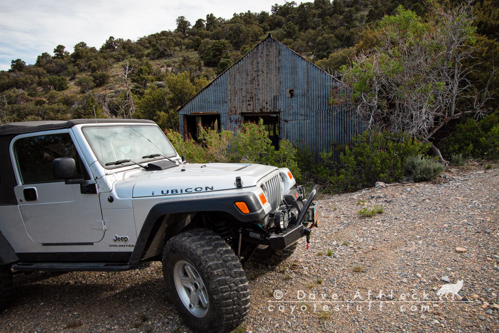
My first stop of the day was the old mining camp of Tybo.
Tybo was founded in the late 1860’s. A smelter was built in 1871 and by 1875 a twenty stamp mill had been added. Tybo’s boom years were 1875 – 1877, when the population peaked at around 1,000 souls. Tybo is not quite a ghost, as there are a few residents even today.
Here is what upper Tybo looked like in 1875:
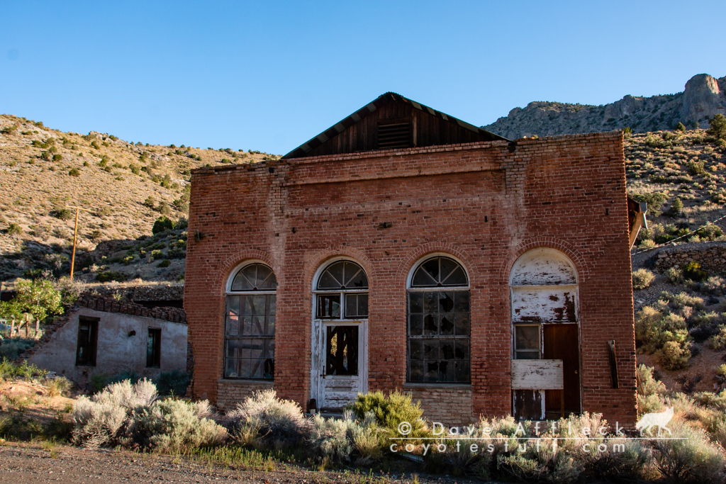
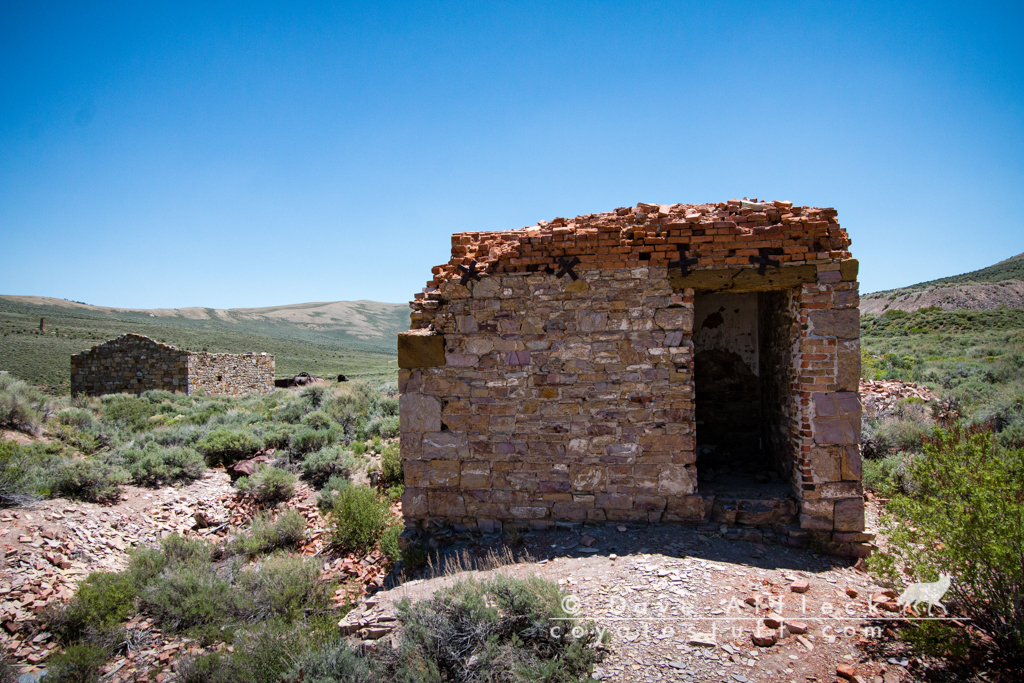
And some pictures of Tybo today.
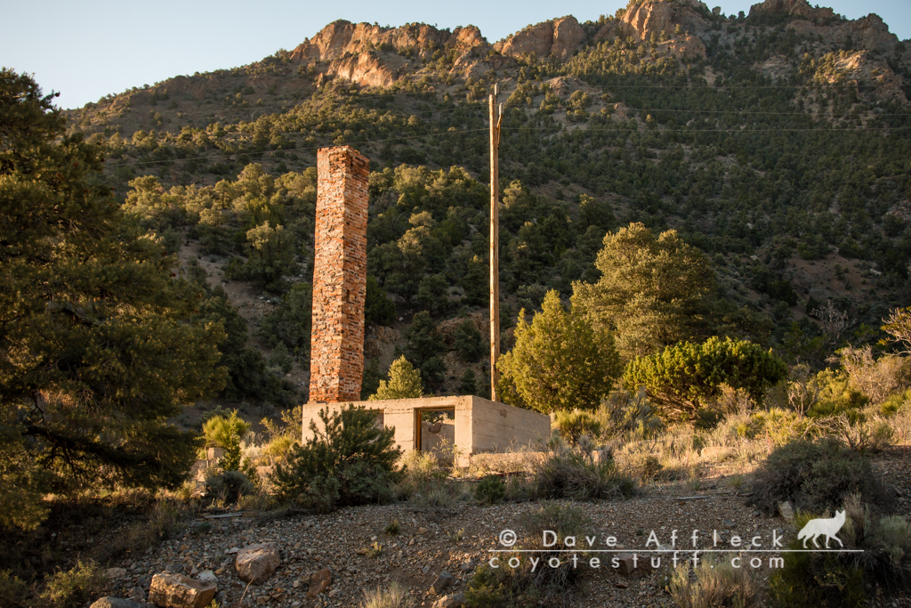

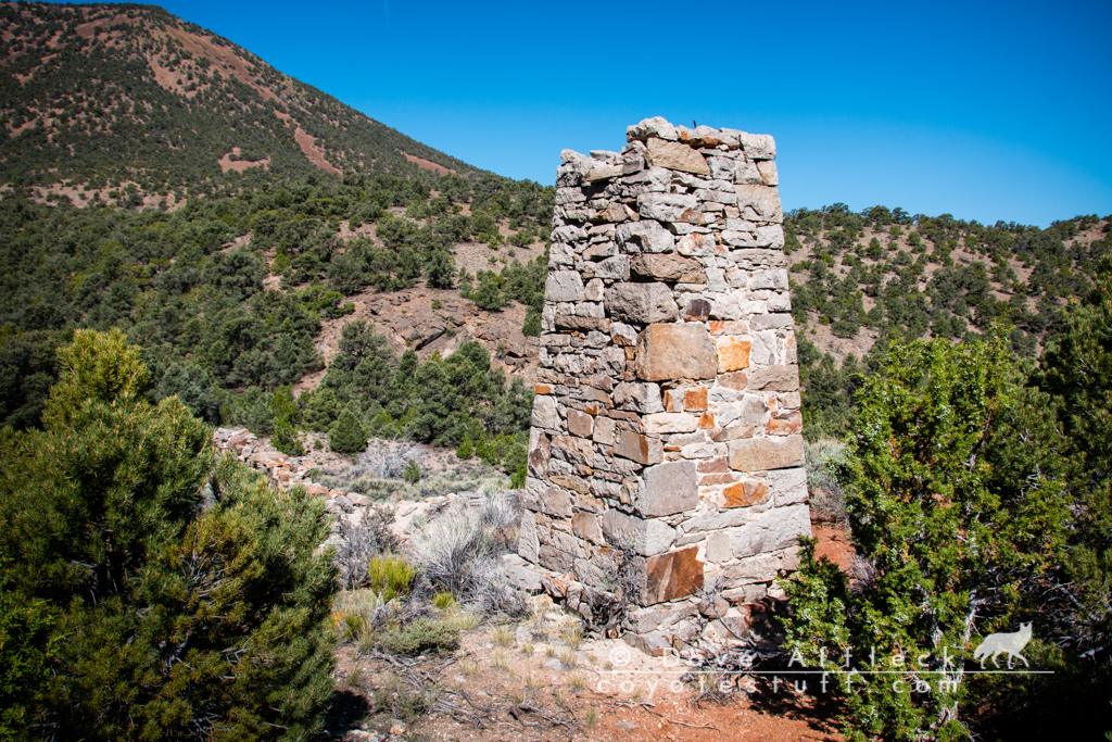
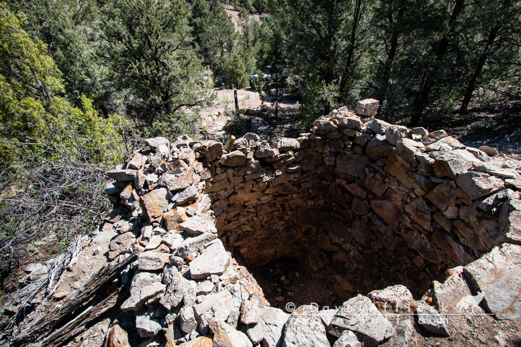
These kilns were built in 1872 and are very well preserved.
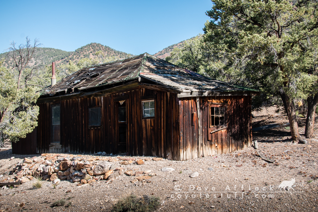
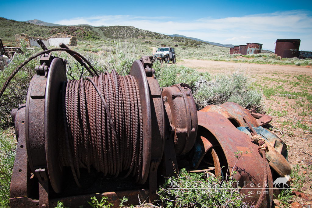
Mountain View Arrastra
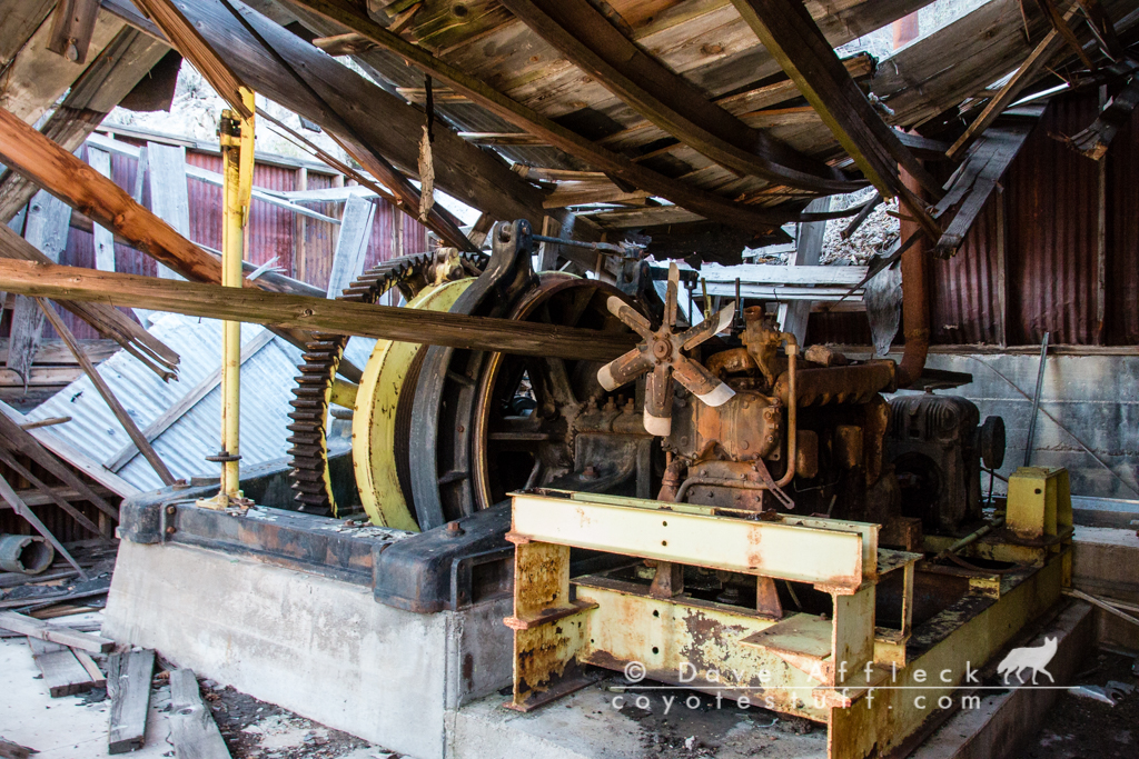
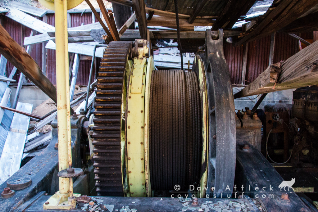
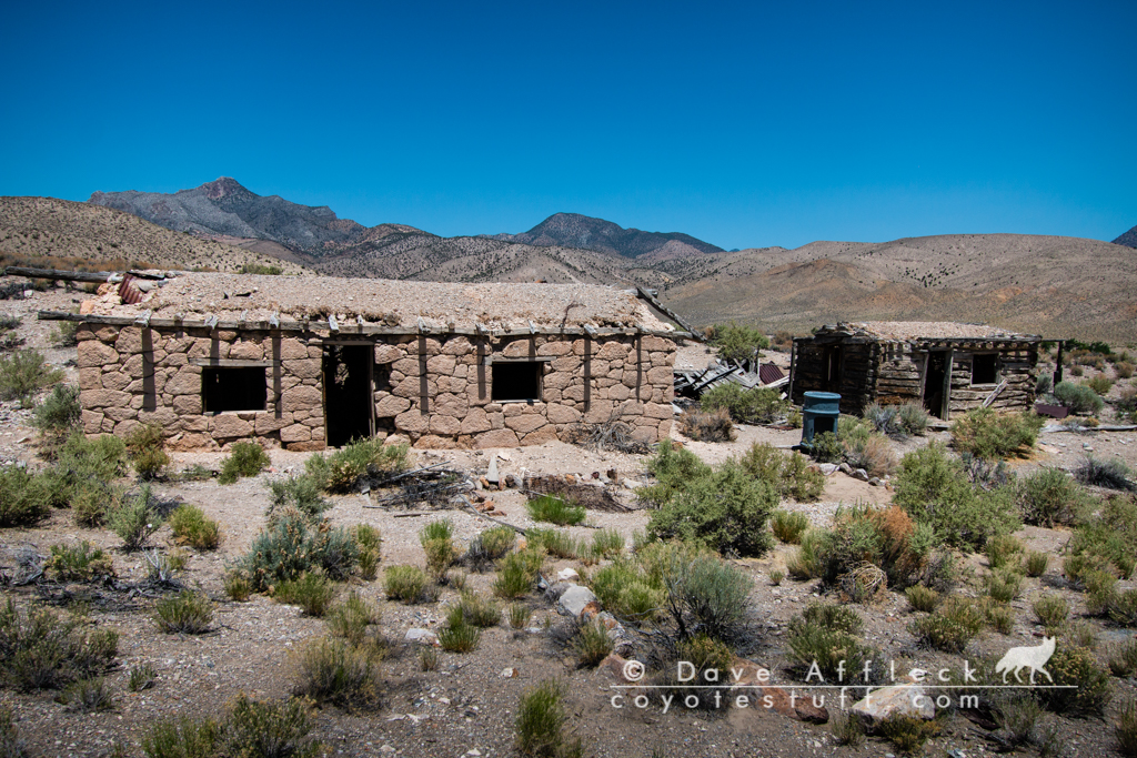
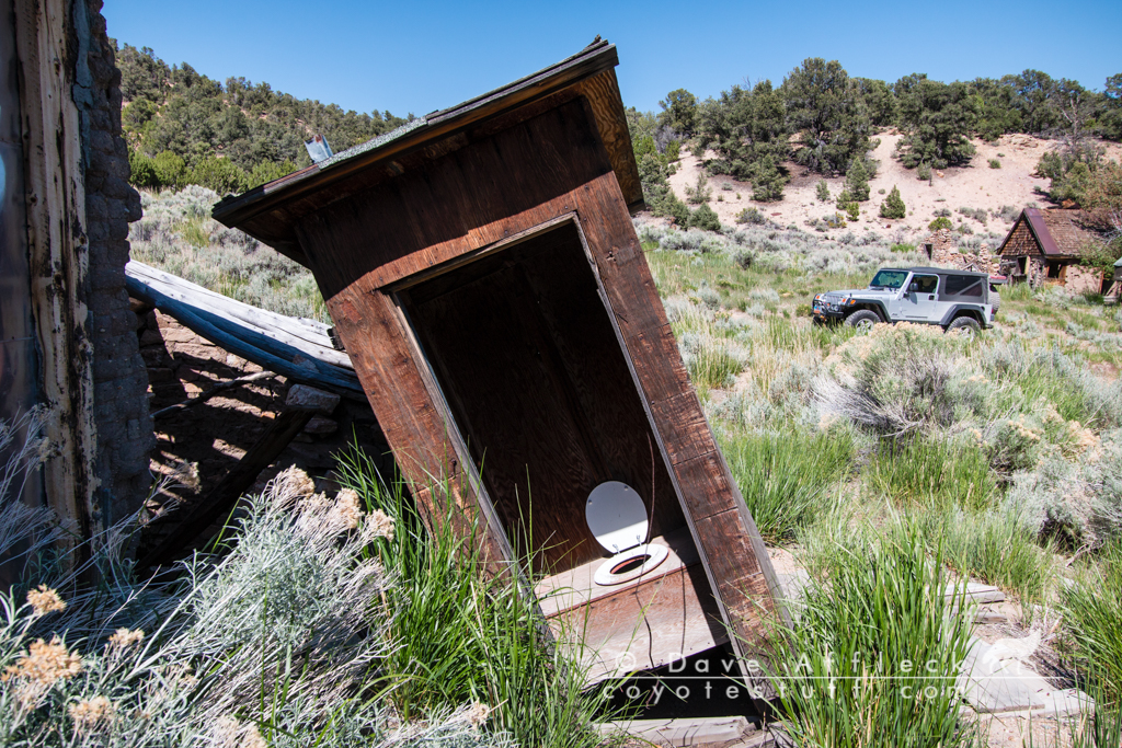
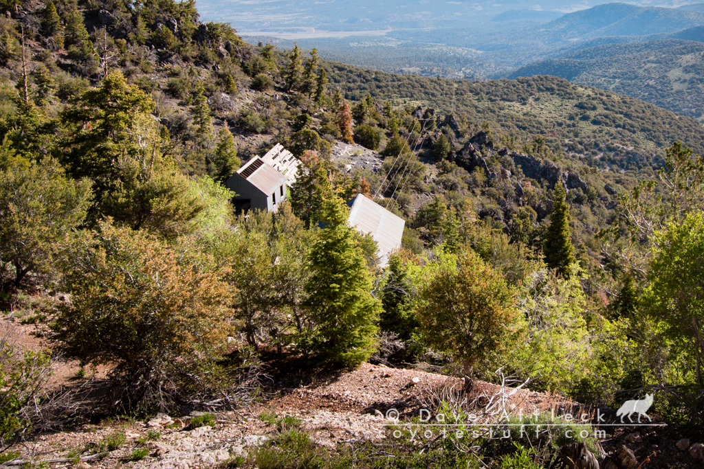
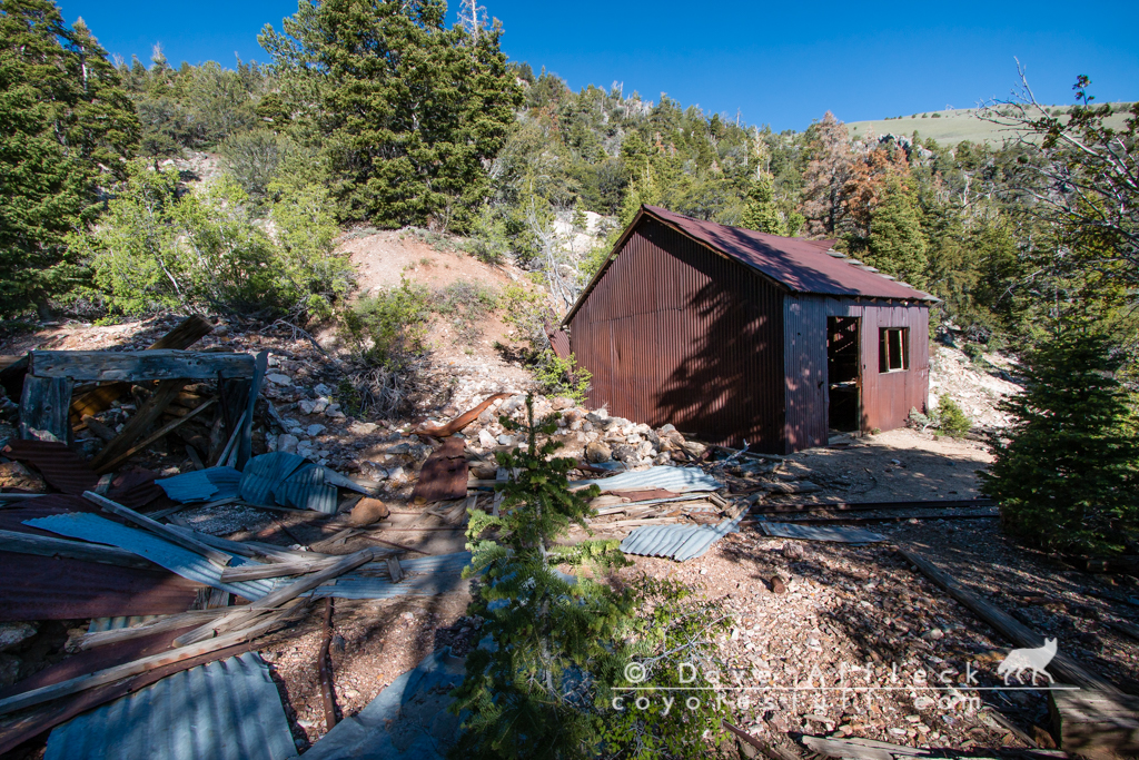
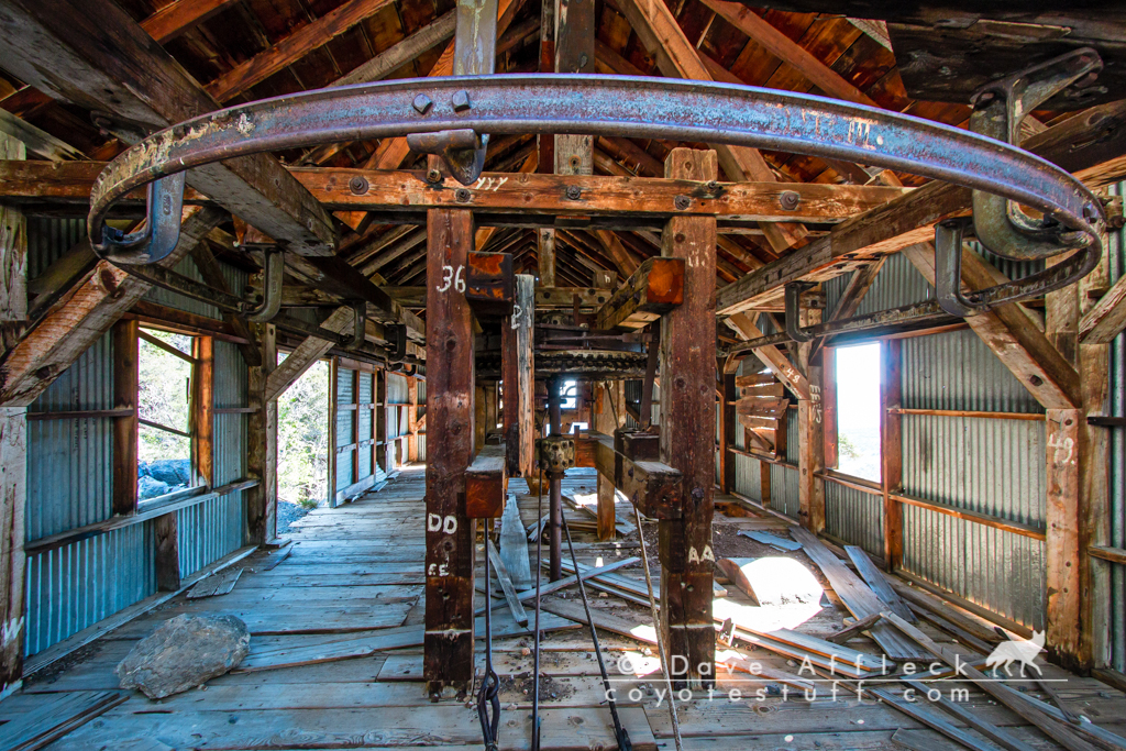
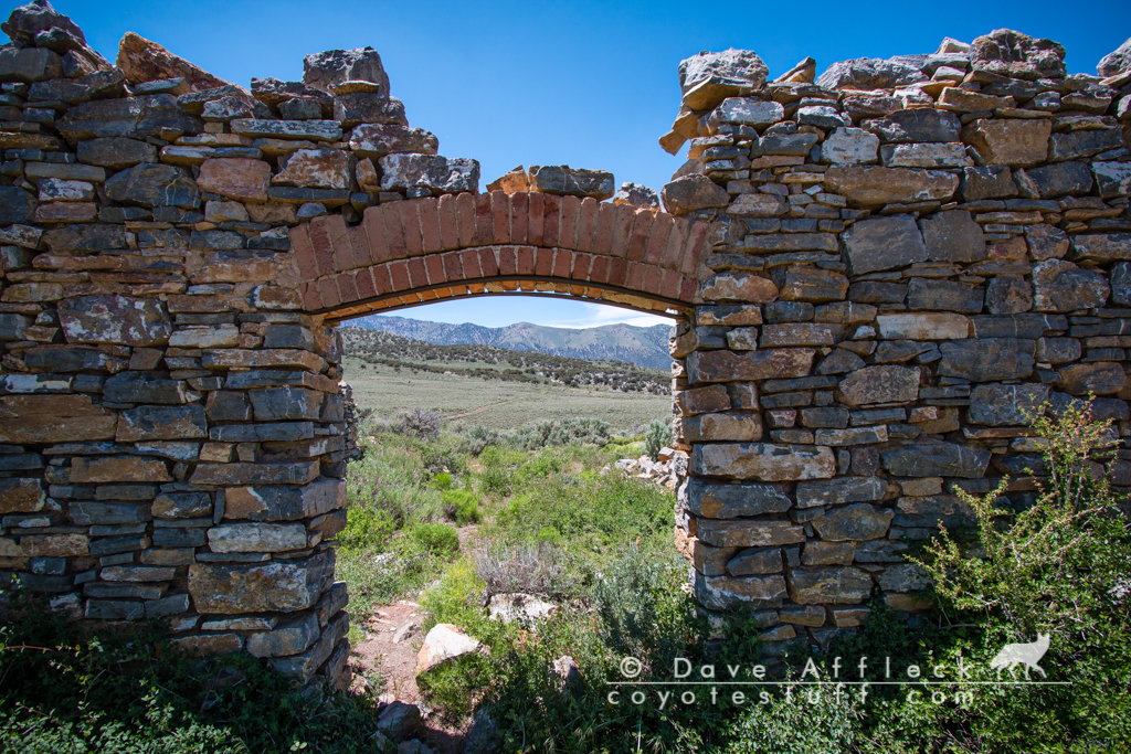
Next up, was a place I’ve “had on my list” for a long time. Really, this was the biggest impetus for the whole trip. Mountain View. High up in the Hot Creek range. Not much seems to be known about the history of Mountain View. It gets little or no mention in any of my books on the ghost towns and old mines of Nevada. Paher mentions a mill being built in 1908. The remains of the mill are still there. From the looks of the mill and the looks of the mine tailings, I think the builders of the mill were wildly optimistic and bitterly disappointed.
Some pictures of Mountain View.
It’s a testament to how few visitors this area gets that most of the window glass was still intact in these long abandoned old cabins.
Of most interest at the site though, and what brought me here, is an arrastra, sitting all by itself in the bottom of a small canyon a mile or two from the mill. I’ve wanted to check it out ever since I was told about it years ago.
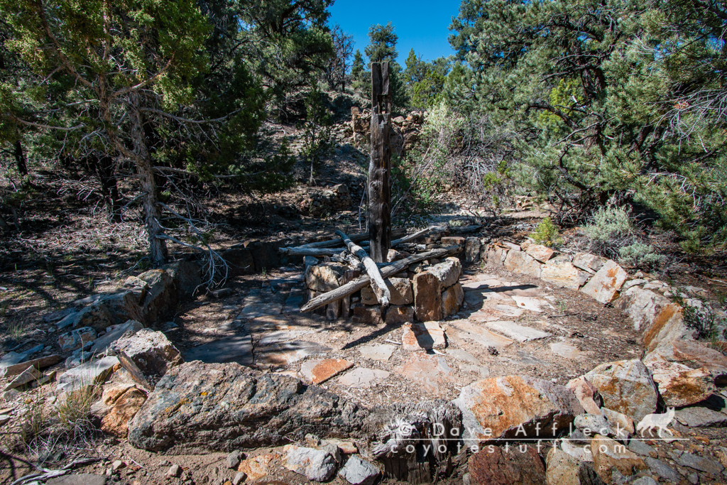
Right above the arrastra, is this large cistern.
Largely reclaimed by nature and buried was what looked like a very short “canal” for channeling water from the cistern to the arrastra.
This arrastra presents a tantalizing mystery to me. I think it must predate the mill, I mean, who needs an arrastra when you have a mill, right? But there is also a very pronounced lack of 19thcentury mining detritus in the area around it. No tom can dump, scarcely any tin of any kind at all. I hiked up the ridge above for a look around and couldn’t spot any kind of mine portal or tailings piles. And that cistern… How did it get filled? And from where? Even assuming a much wetter year, or even a wetter climate and flowing water in the bottom of the canyon (the creek bed was bone dry for my visit), the only way I can think of to have filled the cistern would have been buckets. A very labor intensive way to process ore, right?
Spanish? That would make it very, very old. But would explain the lack of typical 19thcentury artifacts and could also explain how and why so much labor might have been expended on such an apparently small and short lived operation. Since the Spanish miners often employed slave labor.
I really don’t know. But the possibility of Spanish activity in this area, and such well preserved remains, if indeed of Spanish origin, is some pretty cool stuff for anyone interested in such things. Pretty dang neat, either way though!
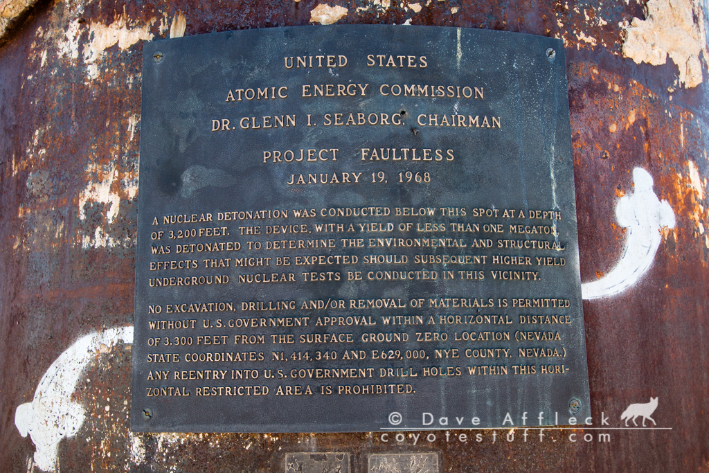
Project Faultless
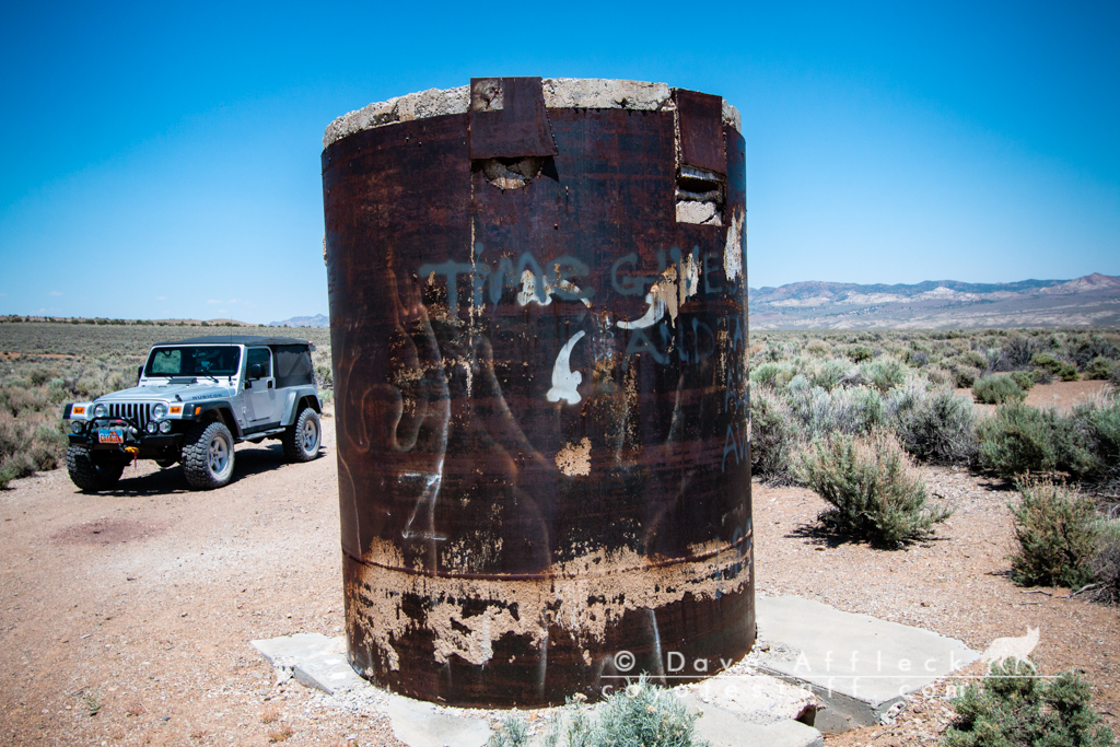
From Mountain View, it was back to the desert floor and north again to check out the Project Faultless site. The site of an underground nuclear bomb test in 1968. The hole capped by the big pipe was drilled almost a mile deep at 4,650 feet. The bomb was detonated at a depth of 3,200 feet. The test explosion on January 19, 1968 was just under a megaton, the equivalent of just under 1 million tons of TNT. Almost 50 times more powerful than the bomb dropped on Hiroshima, by comparison.
The explosion ripped a trench 4,000 feet long up to 20 feet deep and up to 100 feet wide. A 12 acre area immediately surrounding the drill hole casing dropped 12 to 14 feet! At the time of the explosion, the top of the pipe you see was level with the ground! Or more accurately, the ground was level with the pipe. Knowing this while looking around the site, you can get a feel for just how crazy that is. In Ely, 90 miles away, the aftershock caused tall buildings to sway and windows to crack.
This was more than bargained for and two more tests that had been planned for the site were scrubbed.

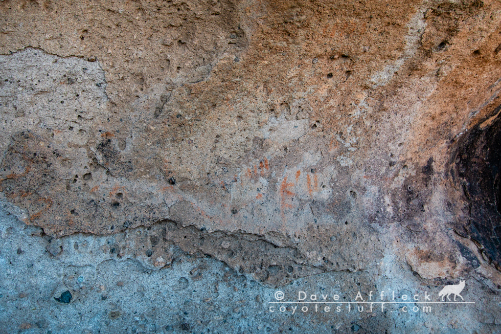
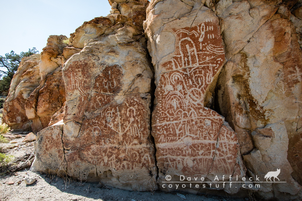
Looking For Rock Art
After a quick lunch there at the atomic test site, I decided to go check out something I could see on my map. The USGS quad sheet showed a “pictograph” on the east side of the valley over in the Heart Hills. I chose the less travelled two track across the valley then a few miles more on a rough trail, before setting off on a short walk to look for the rock art. I spotted a likely looking rock shelter and sure enough, that was the site of the “pictograph”.
Unfortunately, the rock art was heavily exfoliated and faded, to the point of barely recognizable as even being man made. Oh well, sometimes you score, sometimes you don’t!

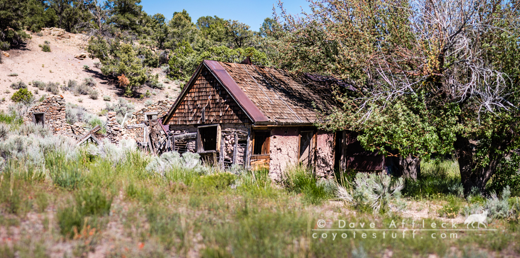
Morey
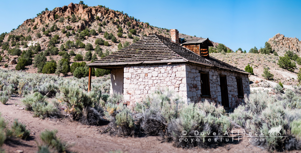
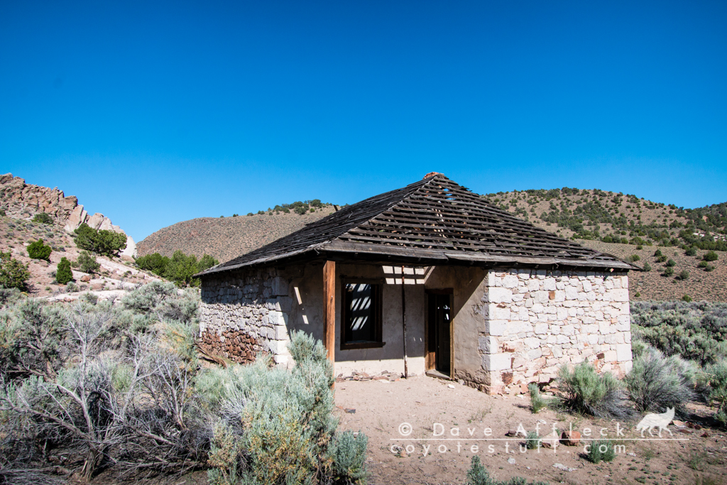
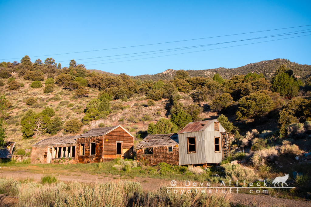
After the pictos, it was on to the next stop at Morey. Morey was founded in 1869, had a post office by 1872 when the population peaked at about 100. The post office closed in 1905. The town was deserted by 1909. A landslide in the 1950’s obliterated most of the buildings. But what is still left today, is thoroughly delightful! A cluster of picturesque buildings on the edge of a beautiful green meadow where wild mustangs were feeding as I pulled up.
I should probably mention… I had a helluva time getting to Morey! I had never been there, of course. In addition to visiting Morey I also wanted to check out the canyon immediately south, called South canyon (what else, lol!). Anyway… I started up what looked like the most direct route to South canyon on my map. Got half way up and lost the road. It had been getting rougher and rougher and more and more faint and hard to find, and it finally just petered out and quit. So… Back down I went. Then took the next turn, which looked to be the most direct route to Morey. And, it actually was, I suppose, the “most direct” route. But, man, was that ever a rough, punishing, treacherous drive! In most places, the road scarcely resembled a road. Just a rough baby head to bowling ball boulder covered swath is all it was for the most part. Took me way longer to get to Morey than I had expected. But of course when I finally did get there, I see a decently maintained Forest Service marked road, that’s not on my map, that I could have taken, ha-ha!
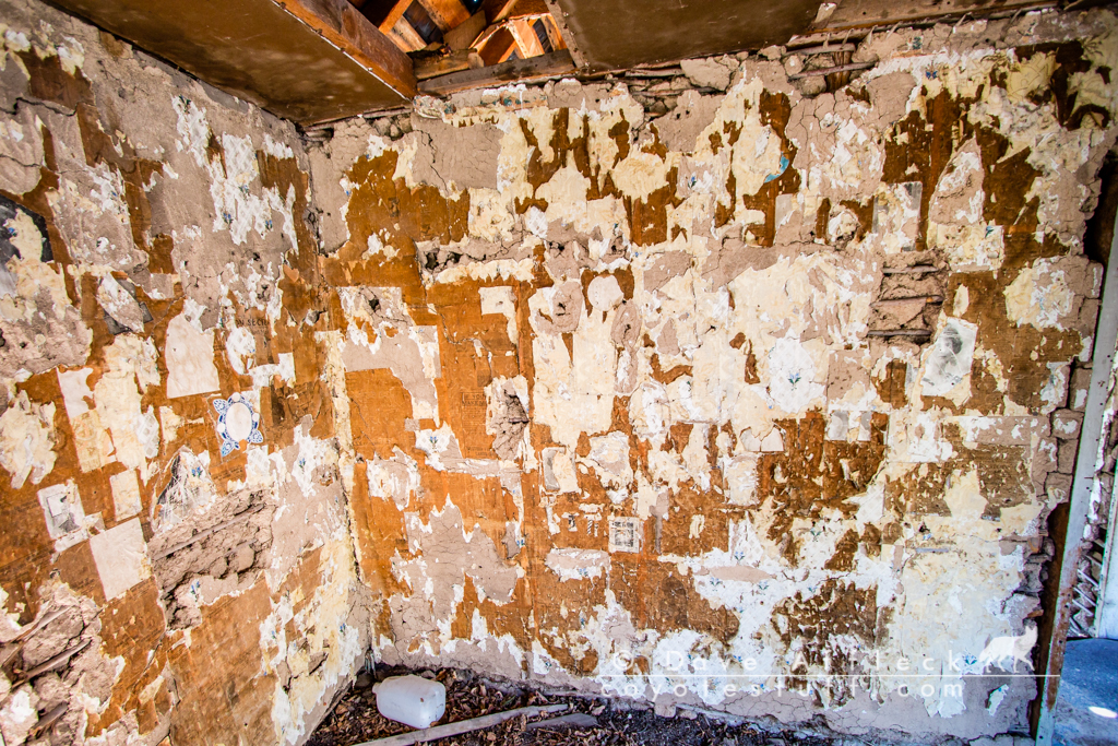
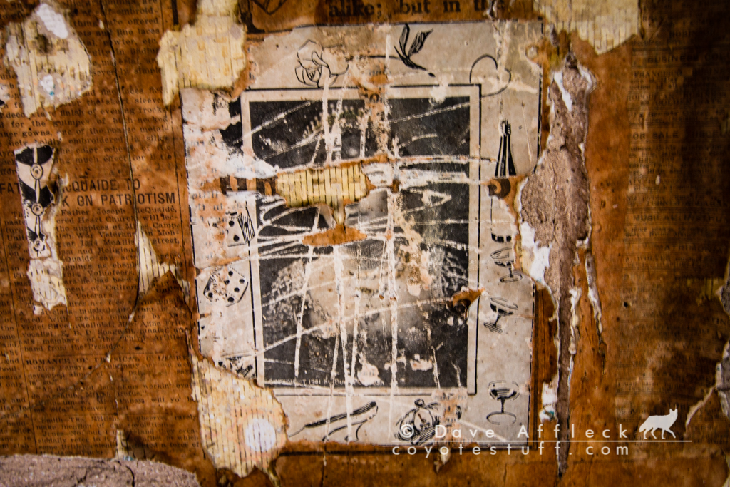
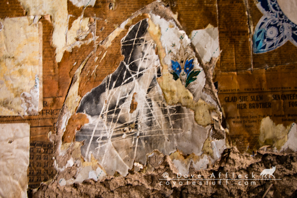
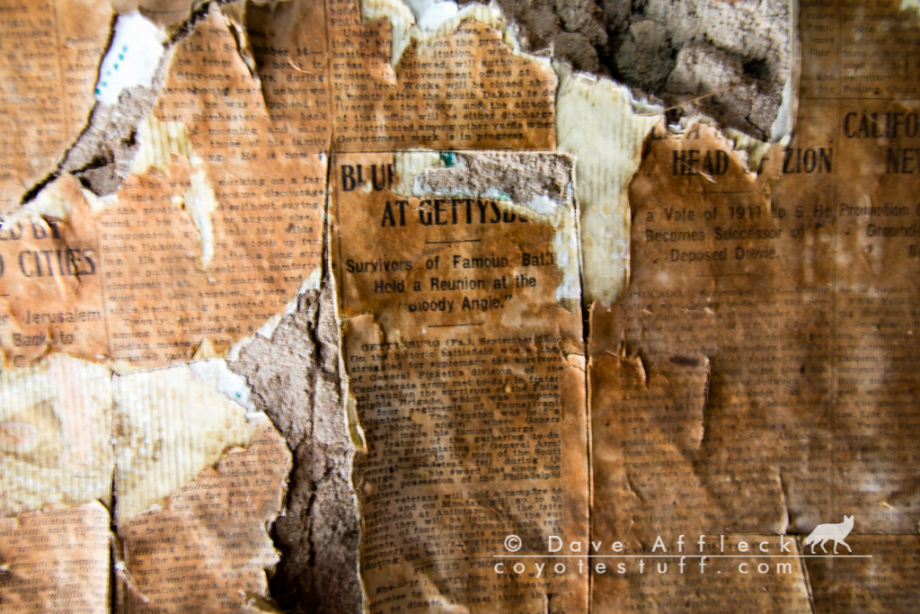
Some pictures of Morey and South canyon.


This cabin had one room mostly wall papered with newsprint. I spent some time just looking at the headlines. Looks like the paper used was from 1911? Check out the one headline “Battle of Gettysburg Survivors Reunion”. Looks like they also had some lovely ladies on the wall, ha-ha!
Finding Rock Art
From Morey, I took the much better road back down, then headed for another brief stop at another rock art site I have been to before, petroglyphs this time.
There are petroglyphs on many of the rock faces up along this rocky gulch. This is only the second time I’ve stopped here to look but I found several panels I had not noticed the first time and I’m sure there are still a lot I haven’t found yet.
Belmont-Tybo-Eureka Stage Line
At various points during the day, I had been following the route of the old Belmont-Tybo-Eureka stage coach line, which ran in the 1870’s and 1880’s. Leaving the rock art site I was running right along it. The first old stage station I’d see today was Moore’s station. It’s privately owned and gated, and I’ve seen it a few times before, so I didn’t stop. But if you can get permission to go in and look, it is amazingly well preserved, a very classy old stone structure.
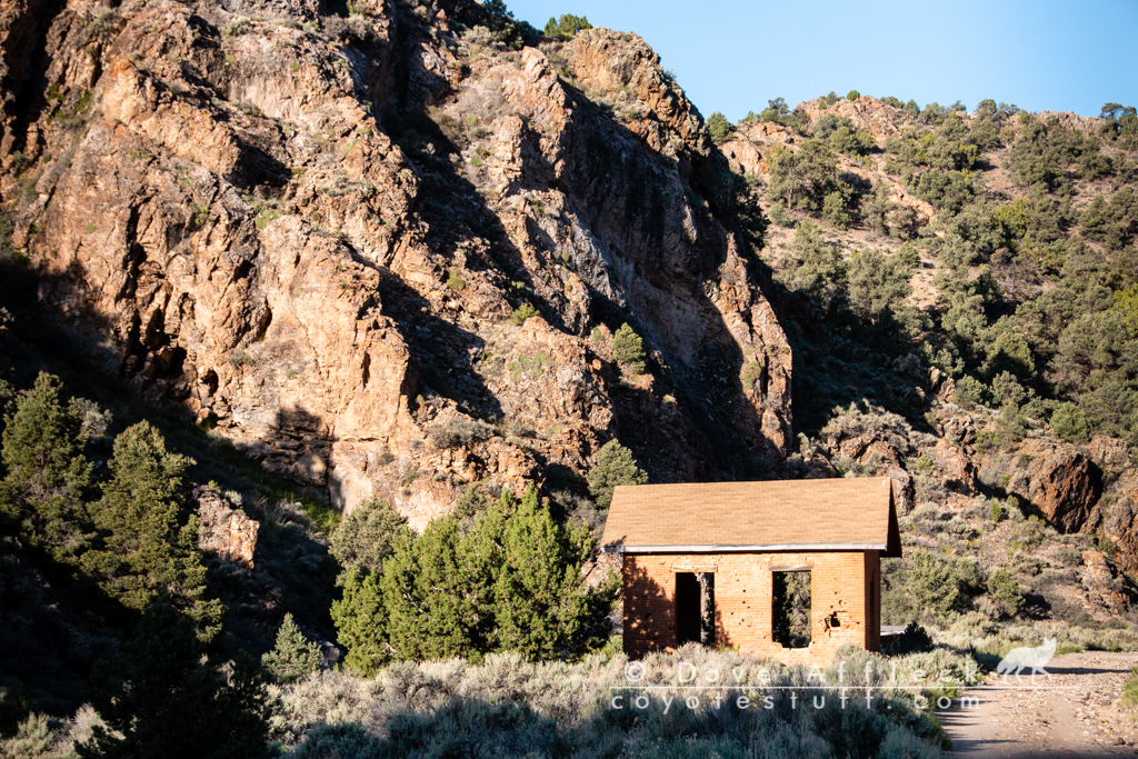
Continuing along the old stage route though, brought me next to Pritchards station, established in the early 1870’s. It’s a pretty neat site and structure in its own right.
Long Way To Go, Short Time To Get There
From there I continued up Pritchards canyon to where it empties into Little Smoky Valley at Summit station. Summit station being the next stop on the old stage line. Nothing remains of Summit station however. Just miles and miles of empty miles is all you can see from there.
On my “someday list” is a trip just to try and follow as much of the original stage route as possible. I have done bits and pieces of it over the years for nearly it’s entire length, but it would be a really cool trip just to concentrate on trying to follow it all the way from Belmont to Eureka.
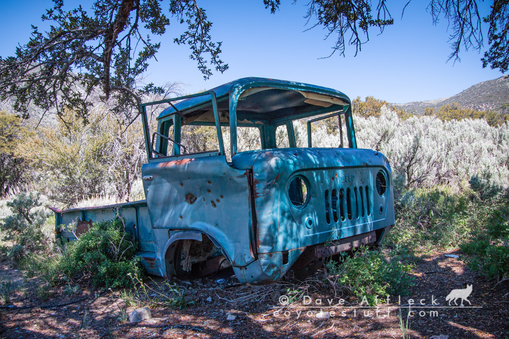
From Summit station I turned east and then north to cross Brown Summit with Moody Mountain on my left. Seeing something possibly interesting on the map, I made a side trip. On the map was a site called “Florio Outrider Cabin”. Outrider cabin sounded like something I needed to see, so I took the bumpy Jeep trail side road all the way there. Only to find, in the words of Yukon Cornelius, “nuthin”. It was a gorgeous, gamy looking area, lots of jackrabbits hopping around and stuff, but even after hiking around a bit, I didn’t find any sign of any cabin. That happens a lot, just going off to investigate points of interest on the map that I know nothing about, but it’s all good, I was having a glorious day all around.
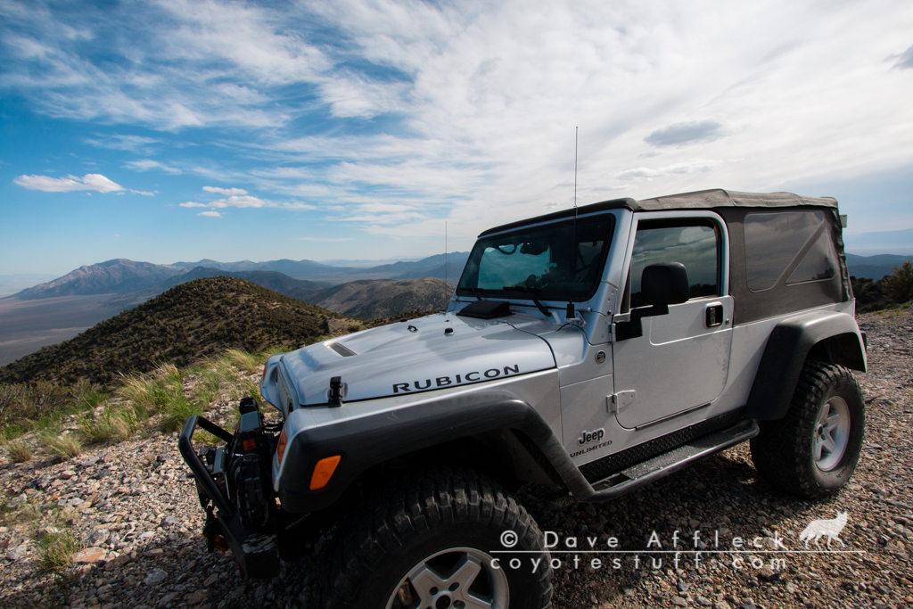
From there though, I had a decision to make, as it was getting towards evening and I’d need a camp spot soon. I decided I’d like to get all the way up to Belmont Mill to camp for the night. But to get there before dark, from where I was at the moment, was a long ways to go and a short time to get there. So I decided to put the fancy new Falcon shocks on my Jeep to the test and put the hammer down, lol! Seriously though – I had a long way to go quickly if I wanted to be there before dark and I did push my Jeep right up to the line in terms of both punishment to the vehicle and danger for the driver. Me and the old LJ were hanging it out there. In other words, I was having way too much fun!
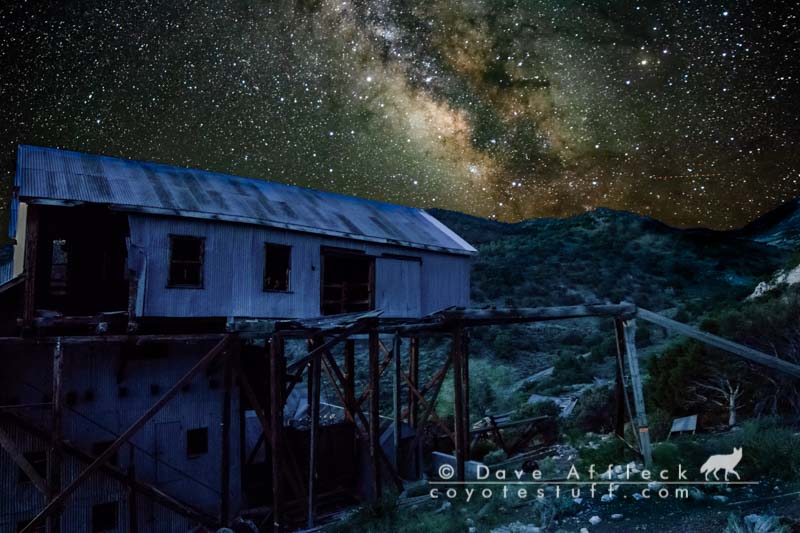
And I made it to Belmont Mill in plenty of time to setup my simple camp (cot under the stars again) and cook a steak, then after eating dinner, sit and watch the sun go down with a whiskey and cigar. Life don’t get much more better.
I setup my camera while I slept again to try for a night shot of the Mill. Here’s what I ended up with.

And another short timelapse of the Milky way over the mill.
While I slept that night there by the mill, the wind came up sometime after midnight. The sounds coming from the old mill, caused by the wind, moaning, creaking, random irregular tin slapping, what sounded like boots walking inside the mill (even though I KNOW it wasn’t really footsteps), it got downright spooky, and I really do not spook easy! I slept a bit uneasily the rest of the night.
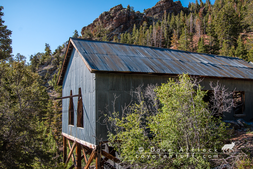
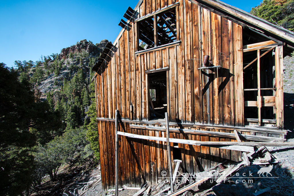
Belmont Mill
The White Pine district got it’s legs in the late 1860’s when the “White Pine fever” created the “White Pine rush”, with 13,000 claims filed in two year period. Spawning many brief lived but colorful and vibrant camps and towns, including the Belmont mill, Shermantown, Eberhardt, Hamilton and Swansea and many others. At it’s peak in the early 1870’s the district was home to over 30,000 men. With Hamilton alone as the main hub of the area and seat of the newly created White Pine county topping out at 12,000 souls and Treasure City home to another 6,000.
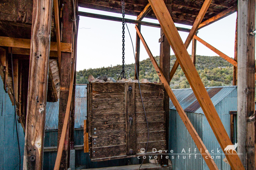
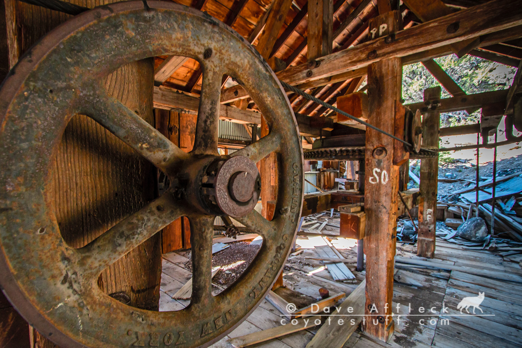
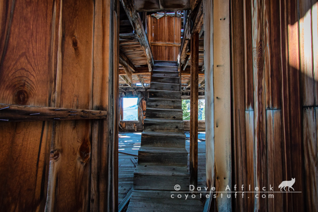
The Belmont Mill is a true gem! Originally built in 1866, with a refresh in the early 1900’s, the mill is still very intact, including a 1.5 mile long tramway still standing.
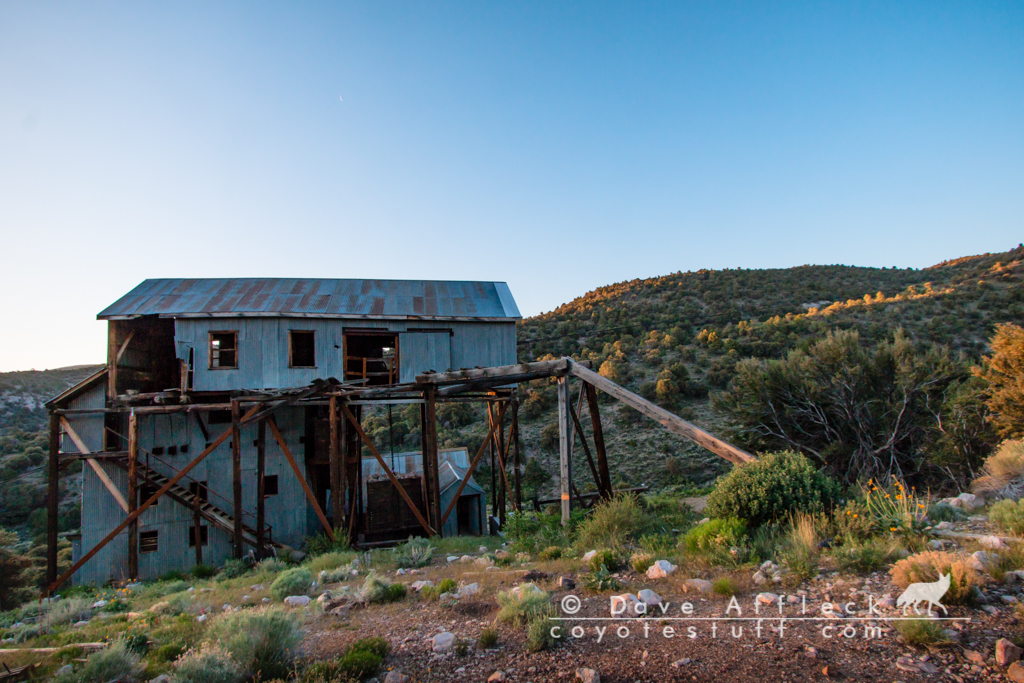


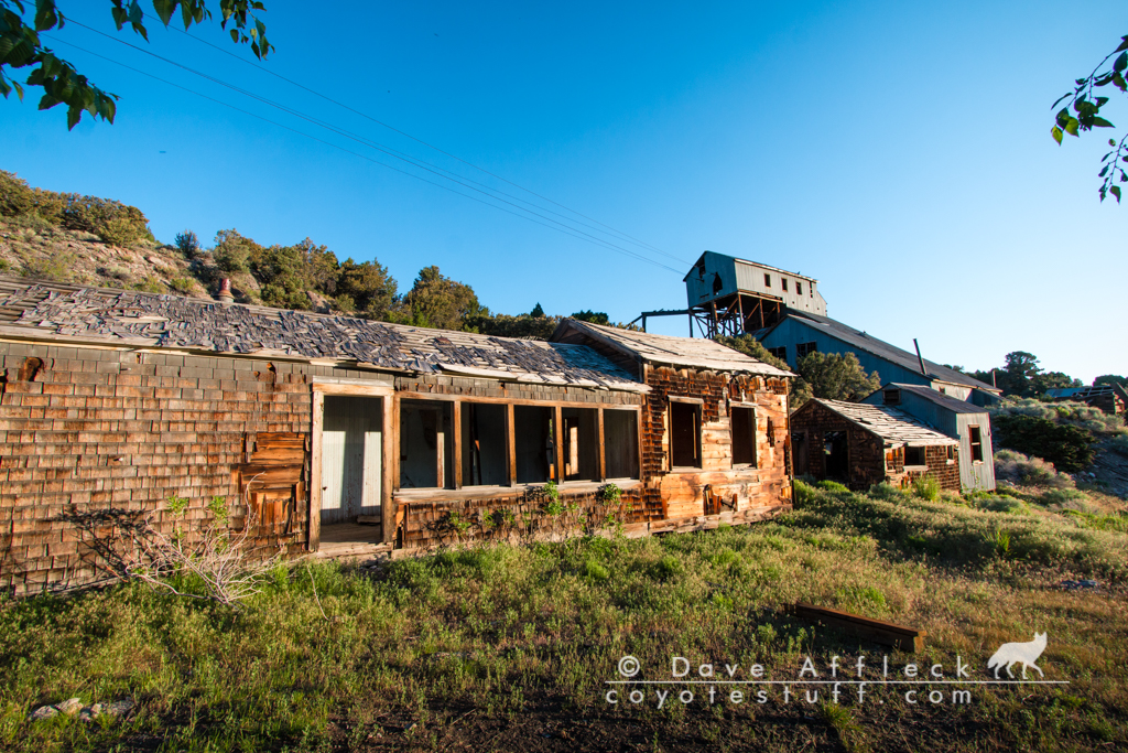
Belmont Mine
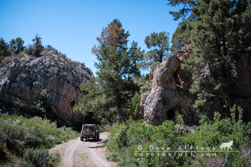
After poking around in the hills around the mill, I headed up to first the Mary Ellen mine, then the Belmont mine and the top of the tram. Per my usual habit, I attempted taking what appeared to be the least traveled route, but first one old mining shelf road dead ended, then another got a bit sketchy, and I ended up taking the road up McEllen canyon and then up a decently rough shelf road to the mines. It was just a glorious morning for a Jeep ride! The canyon was beautiful, the shelf road took me up into the tall cool shaded pines, the coffee was tasting good, my cigar was awesome. I just love mornings like this!


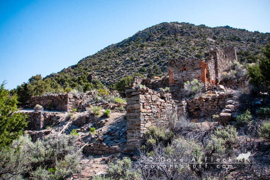
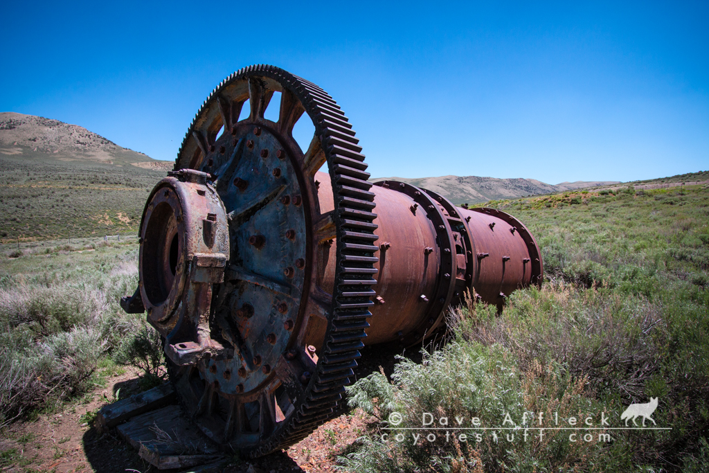
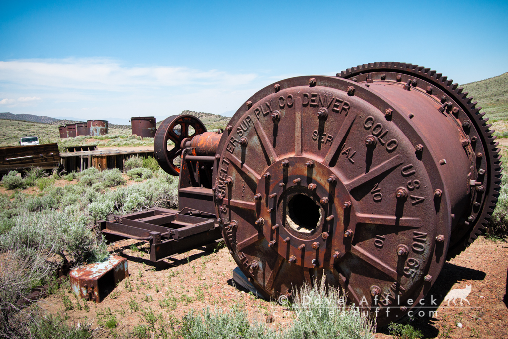
Shermantown, Eberhardt, Treasure City and Hamilton
From the Belmont mine, I continued my extremely enjoyable Jeep ride up McEllen canyon to Shermantown. Windows down, tunes playing low, just gulping in the sweet smelling air and enoying myself immensely. On the way to Shermantown I took several side trips to check out mines, with names like “Plus Ultra Mint” and “Grand Prize”.


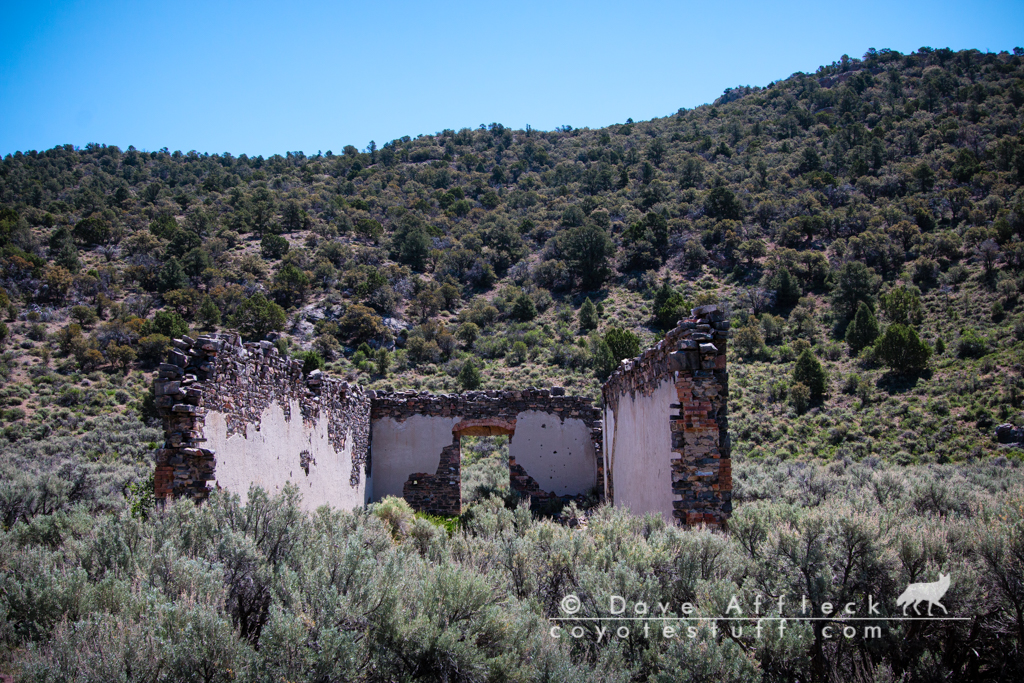
Not a whole lot of Shermantown remains today, but in the early 1870’s it was home to 3,000 people. It was primarily an ore processing and milling town, but when Treasure City took off and the big mills at Eberhardt got going, Shermantown faded into the dust. Stone walls poke up here and there out of the sage brush.
From Shermantown, I made my way to Eberhardt.
What Eberhardt looked like in 1871:

There are a substantial number of stone walls and foundations dotting the canyon floor and walls at the site of Eberhardt. I stopped only to snap a picture or two though.
My Jeep trail had turned into a well maintained and obviously well travelled road and I was anxious to get off it and onto less traveled climes. So I took a rough, switchback, steep Jeep trail along the rim of Eberhardt canyon that the map showed would take me up, up, up all the way to Treasure City; the back way.
A couple shots along the trail to Treasure City.


Treasure City and Hamilton
Treasure city was founded 1867 and had a population of 6,000 two years later in 1869. Fantastically rich ore was being taken from the mines of Treasure hill. But the boom was very short lived as ore values quickly plummeted and the town shrank as fast as it had grown – with a population of less than 500 by 1870. Talk about a meteoric rise and fall! Today numerous ruins and mines litter the landscape on Treasure Hill.


And then I dropped off Treasure Hill to check out Hamilton. I was about 30 years too late. Earthquakes and time have destroyed most all of the once picturesque remains of Hamilton. Along with current mining activity, it just isn’t the ghost town it once was ha-ha! But still worth the time to visit!
Hamilton was founded in 1868 and had a population of 500 by the end of the first winter. A year later, in 1869, the population had exploded to 10,000 and would peak a couple years after that at 12,000.
The usual suspects were to blame for the eventual decline and near demise of Hamilton. That is, namely, veins pinching out and a series of disastrous fires in the town. Hamilton never did quite die though. A few people have always lived here and some renewed mining activity in the area taking advantage of newer methods for extracting fine gold has meant that Hamilton has refused to totally fade away. I saw nobody there during my visit though, absolutely nobody.


This was the Wells Fargo office in Hamilton.
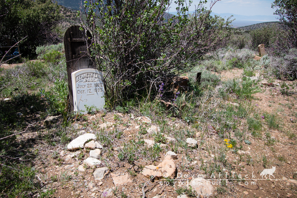
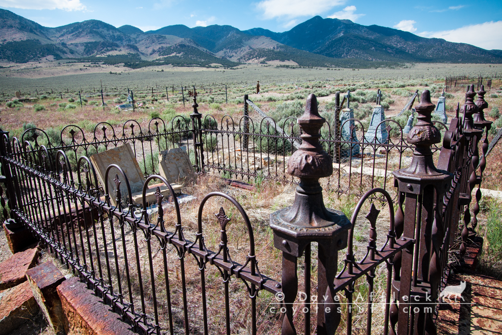
I also visited the cemetery, “Poverty Hill”. I wouldn’t mind being buried here…
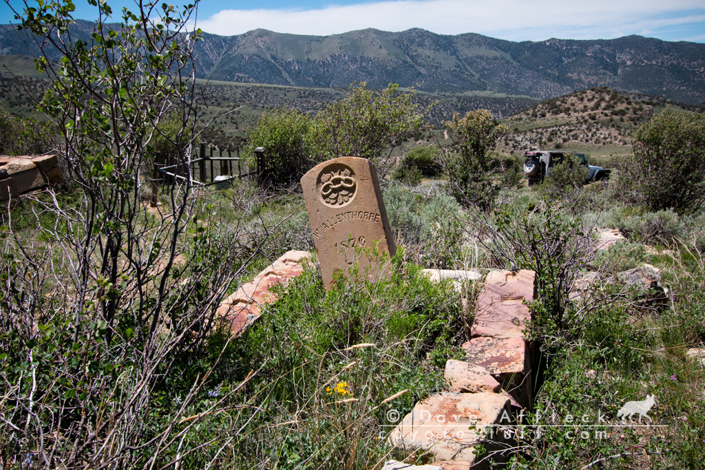
A sign of just how incredibly hard the times were, this family, the Paul’s apparently lost three young children between 1890 – 1894. Can not imagine how hard that would be.

Cherry Creek
Leaving Hamilton I chose the less traveled looking fork in the road and headed north for the highway. Hitting pavement a bit west of Little Antelope Summit, I’d covered 275 miles of dirt. And seen only two vehicles since leaving pavement, both of them the first morning near Tybo. Now I turned east on the highway for Ely and some fuel. I rolled into the gas pump at Ely at over 400 miles since leaving the same pump a few days ealier.
After getting gas, I headed north out of Ely, then west off the highway to Cherry Creek. I want to check out some old mines on the map in the mountains just above the old town
First I stopped at the cemetery. One of those places, I’ve been through Cherry Creek many times, but had never stopped to check out the cemetery before. Classic old west gone to seed cemetery.
Then it was onwards and upwards, climbing yet one more narrow, switchback, shelf road up to old mines.


The wind was absolutely howling up here! I mean, it was BLOWING! Retracing my route back down to the canyon below I tuned in the weather station on my ham radio. Forecast was calling for steady 35 MPH winds with gusts over 55, a frost warning and temps in the low 30’s.
I flew up the canyon and into a major draw I’ve camped in before, looking for any kind of wind break. There really wasn’t one. I elected to put up my tent this last night, considering the weather and all.
You know the wind is blowing when you unroll a heavy canvas tent and the wind carries it away into the trees like a paper towel! I dragged it back, got a stake in one corner and let it flutter from that one corner stake like a wind flag while I hurried and got the other upwind corner staked and then the rest.
Amazingly, and thankfully, in the ten minutes it took me to get camp setup, the wind died down! Not calm, but quite tolerable enough to cook a nice steak and sit and eat it in peace, then sit in my chair with whiskey and cigar watching the sunset.
Shortly after eating, a pair of mustangs wandered almost right into camp from upwind before noticing me.

As the sun went down, the wind picked back up full force and the temperature started to drop and I went in the tent and had a fabulous nights sleep.

Next morning dawned cold and windy. Temperature was 34* and the wind was blowing more than 20 MPH. I wasted no time getting camp packed, coffee made and heading back for pavement and the drive home. Arriving home by 11 AM.
Another great adventure, come to an end!
Pure enjoyment !
Thanks for allowing me to tag along.
Thanks Jody! Glad you enjoy!
That was great. Thank you
You are most welcome Jason. Thank you for reading!
Dave, a great read. I’m going to share this with a older history Buff from Grantsville. He will love it. He talked about heading out to Nevada to see some old ghost towns. He most recently mentioned Hamilton because we are working by Eureka.
Best,
Garry
Hey thanks for stopping by Garry. Hope your friend gets a kick out of this too. Maybe he could even point me towards some new adventure!
Hey Dave,
Outstanding travelogue. Made me feel like I was there, and maybe I was. But mostly, didn’t stop, too busy, you know how that is?
You know, when I see the outposts of civilization, I always ponder how they got that stuff to where it was, must have been a considerable effort hauling that machinery and blazing trails at the same time. Those people had grit! And the cemeteries! Fascinating, and I’ve wandered quite a few just like it. I’m going to send a link to a few people that have no idea that these places exist, and most probably won’t comprehend what it is and what it was; notations such as 12,000 souls, in such a bleak location. I feel fortunate to have been poking around some of this stuff, not very recently. This is good stuff, Dave. Thank you! LB
Thank you for the comments Leonard!
Dave,
Great job documenting this trip, it made me want to plan out a trip myself. Perhaps after my Bookcliffs Archery hunt this August and when the days start cooling down I will head to the desert myself. Thanks for sharing
Scott
Hey congrats on having a Books tag, hope it fills nice for you! I had a rifle Books tag back in 2011, tons of fun scouting and planning that hunt.
Dave another great adventure. I have been to a few of those places myself. Thanks for the great writeup!
You are most welcome Rob. Glad you like it!
Hey Dave, much enjoyed tagging along,,,, Great Write-Up, I like your Style.
I’ll be watching for the next one, you take care and be safe.
BD
Thanks Brad, I appreciate the kind words and I’m glad you enjoyed it!
Dave fantastic as usual! That newspaper wall paper was awsome!
Glad you liked it Mark! I spent a bit of time looking at those old news articles. Like a time capsule.