The Idea
A simple idea, I think Kevin first floated it, drive from the three corners (UT, AZ, NV) to the four corners (UT, CO, NM, AZ). As much of it on dirt as possible.
With a time limit, of course. Eric and I were only able to get away for five days total, so, we had five days to get from Salt Lake, to the three corners, to the four corners, and back to Salt Lake.
And with a slight twist. No route planning ahead of time. We were just going to get to the three corners and wing it from there. Figuring out as we went, how to get in as much dirt as possible, and preferably make it to four corners sometime before the end of the fourth day.
Day One, SLC To Three Corners And Beyond
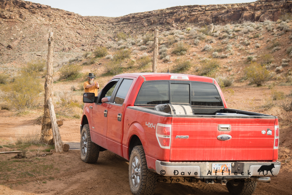
The three of us, me, Eric and Kevin, met at Eric’s house at a fashionably late hour on Wed. morning – about 7am. Then we started the convoy south, Kevin in his Excursion, Eric in his F150, me in my LJ.
ST. George To Three Corners
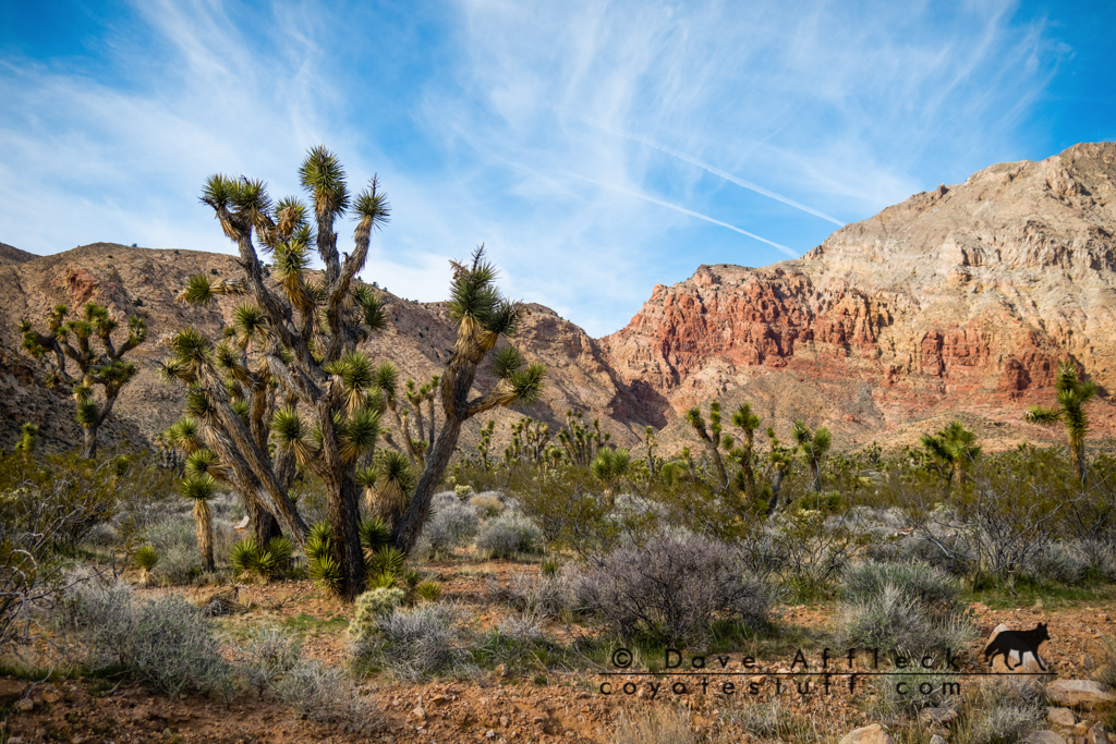
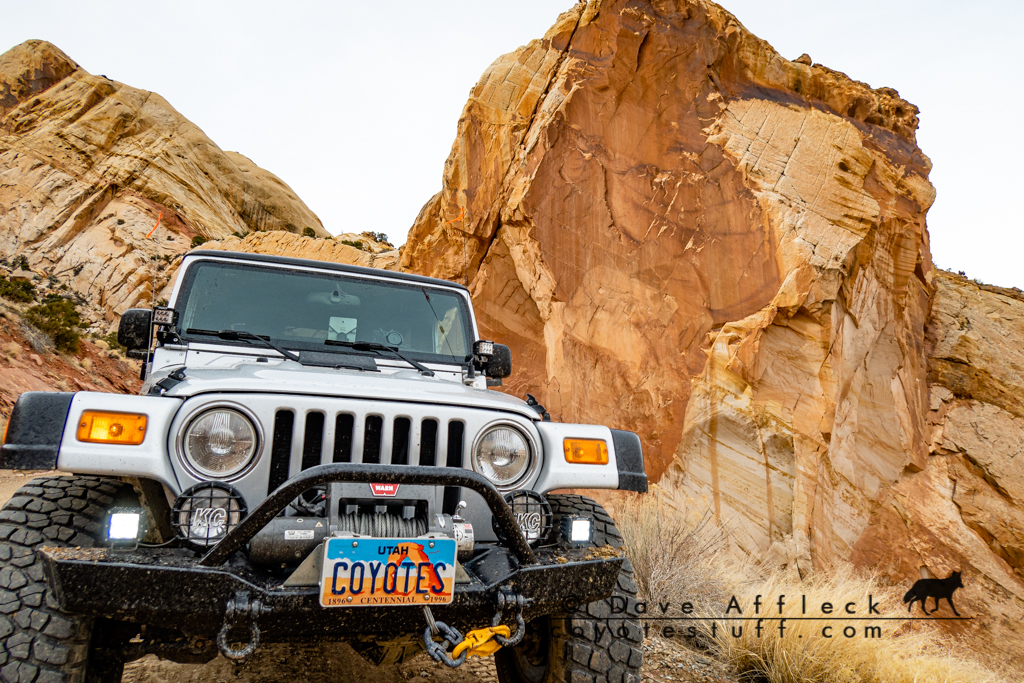
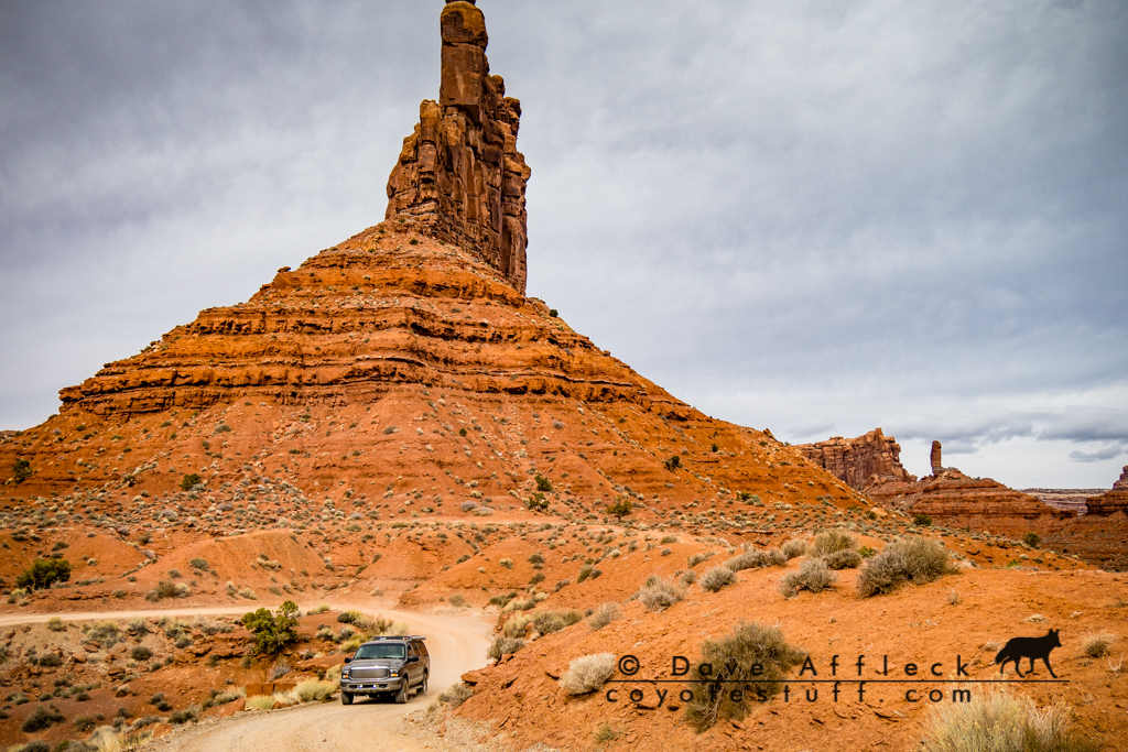
We topped off the tanks in St. George and headed out of town and through the Beaver Dam Mountains for Beaver Dam Wash. With a bit of route finding to cross the wash and choosing the less traveled fork heading generally south we arrived at the Three Corners Monument around noonish.
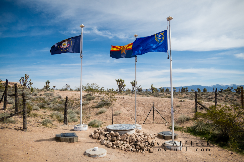
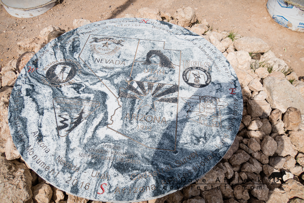
Somewhat surprised to find it fairly crowded on a Wed. afternoon in early March, we didn’t hang around long. We headed further south and then east for Beaver Dam.
Cedar Pockets To Lizard Wash
At Beaver Dam we consulted our maps and the magic 8 ball and decided to escape pavement by taking the Cedar Pockets road back over the Beaver Dam Mountains.
A good call! The scenery in Cedar Pockets was great.
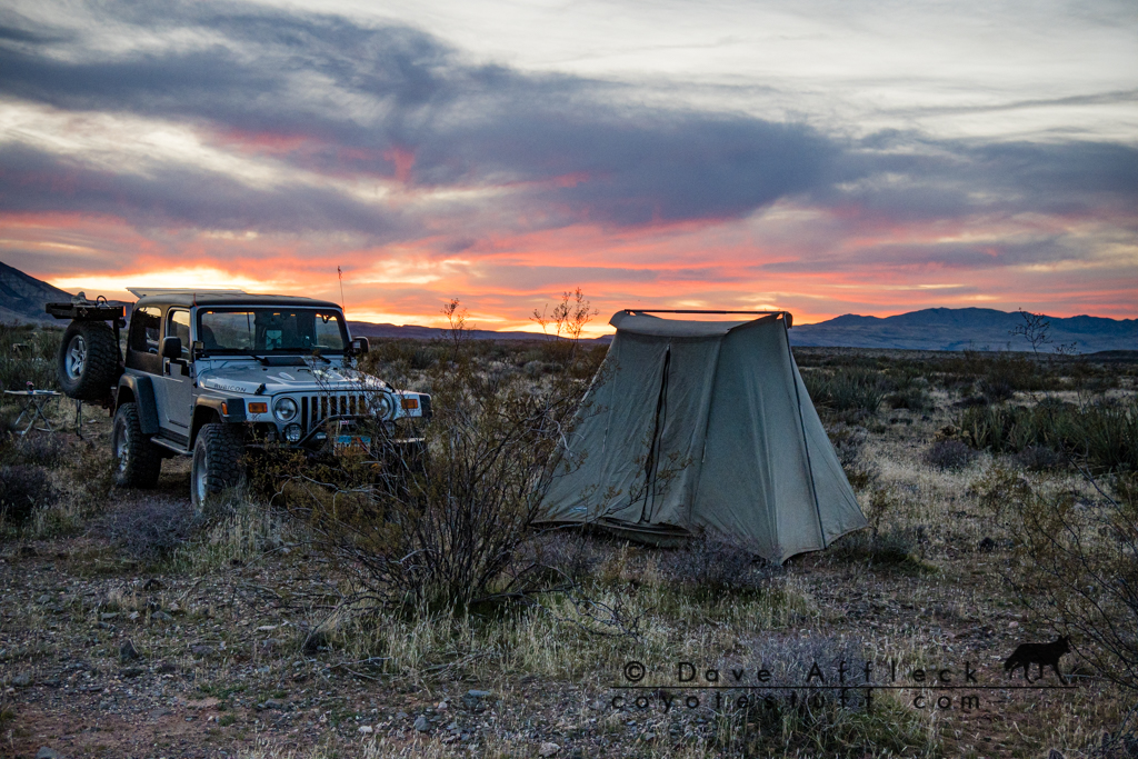
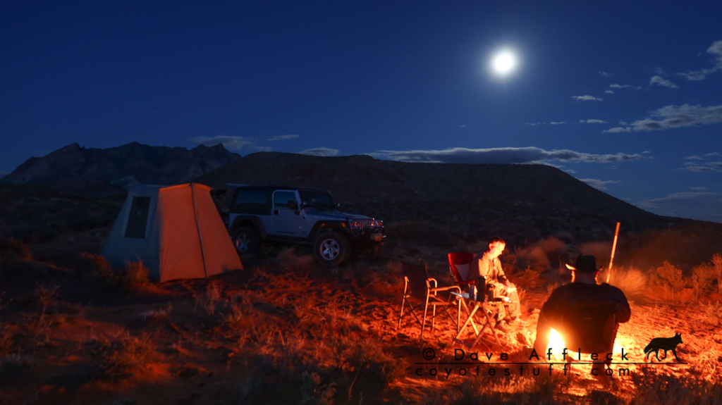
When we hit I-15 again, we pounded pavement north about ten miles to the first dirt that looked like it would get us some distance east, at Black Knolls. Getting late, once a respectable distance from the interstate, we took a random mostly flat spot on the side of the trail to camp for the night.
Day Two, Fort Pearce To Page
In the morning, we continued on the secondary route we were on, headed for Fort Pearce Wash. Which, we connected to and headed east up the wash for Fort Pearce.
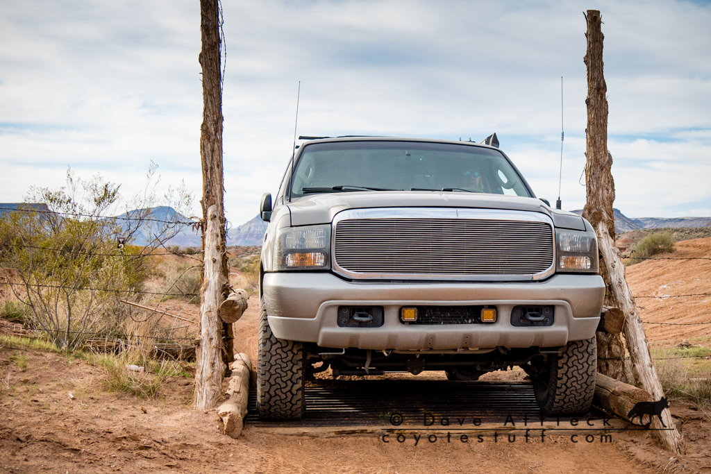
I think this is primarily a side by side route, but we all fit through the width restricting gates, so we were good to go.
It was a fun little drive. My only regret, is we didn’t run into a big group of side-by-sides while in the wash. I’d have loved to have seen the looks on some of their faces seeing Kevin’s Excursion leading the way up that trail!
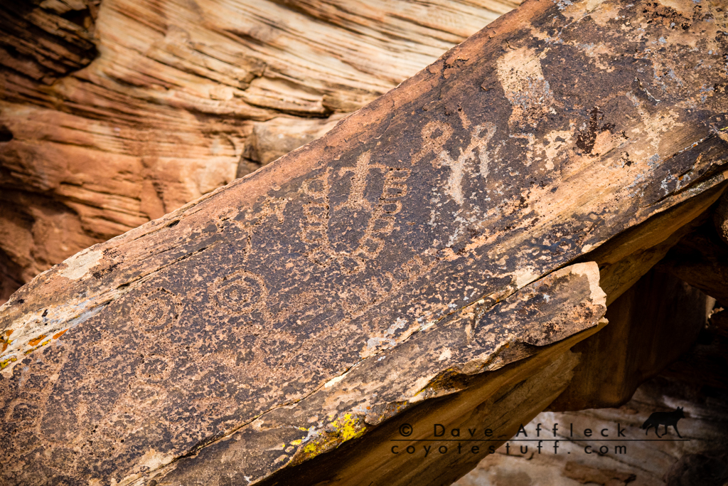
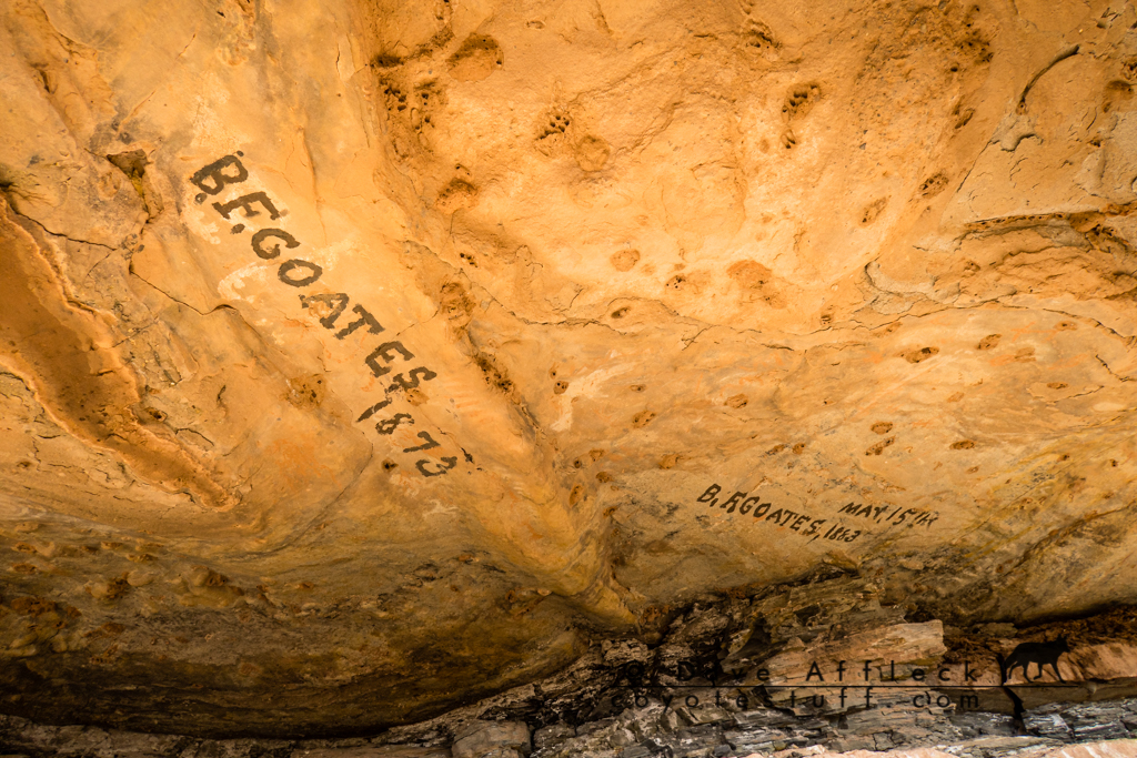
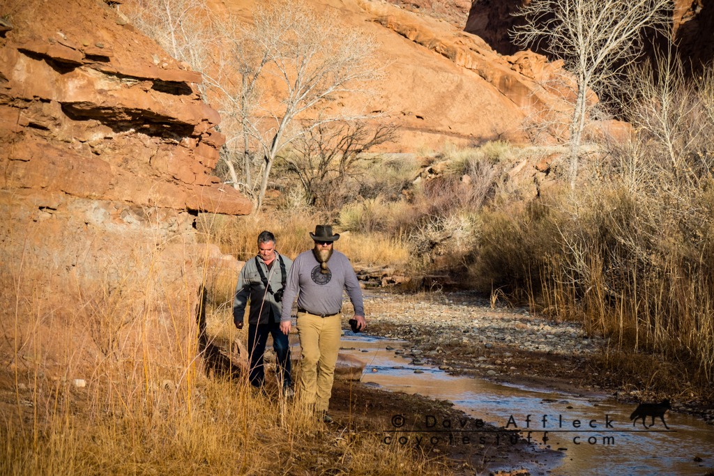
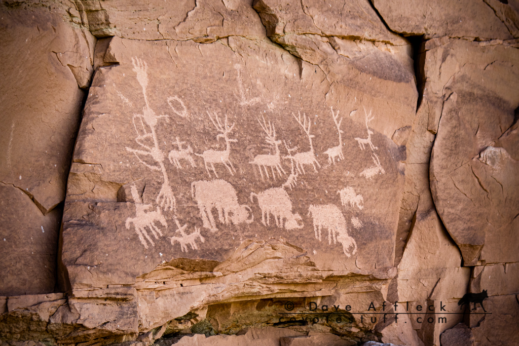
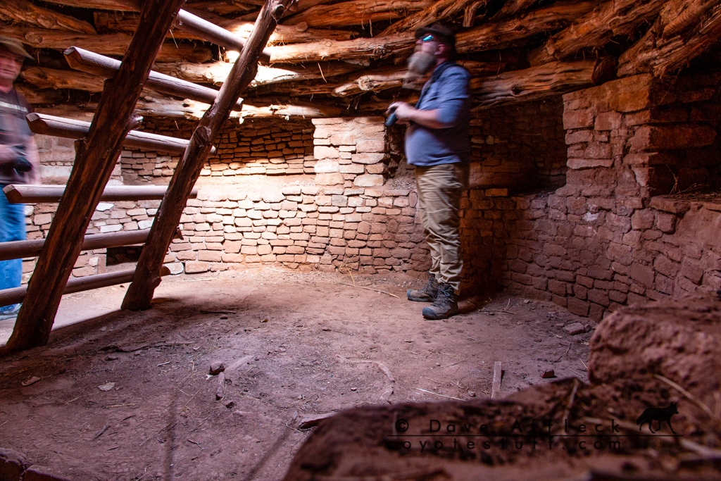
The wash eventually led us to the ruins of Fort Pearce.
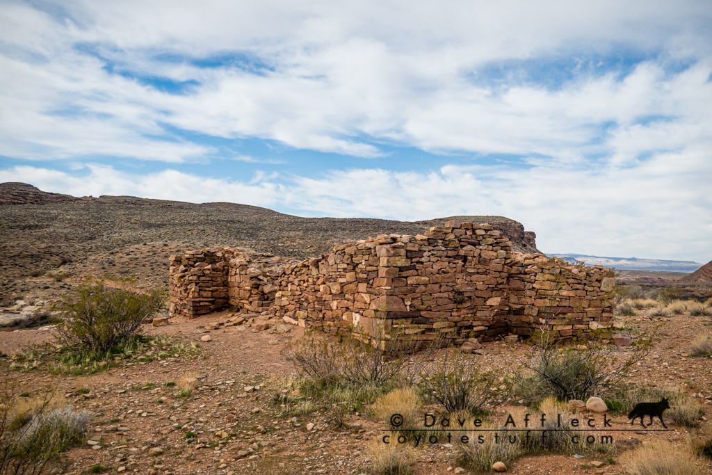
The fort was erected in 1866, during the Black Hawk War – a period of fighting between the Mormons and the local Ute and Navajo tribes intent on driving the Mormons out of the area. The wash was a natural pathway for coming and going for raiding parties. The site overlooks the only natural spring for miles, in a high walled narrow section of the wash. No fights took place at the fort, but it was manned off and on until 1873.
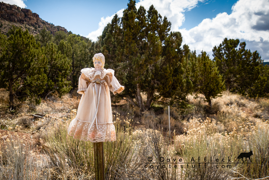
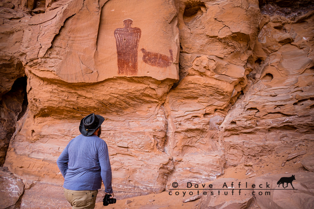
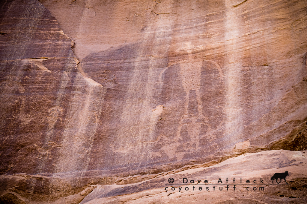
We took some time here to walk around and look at some of the rock art and pioneer inscriptions near the fort.
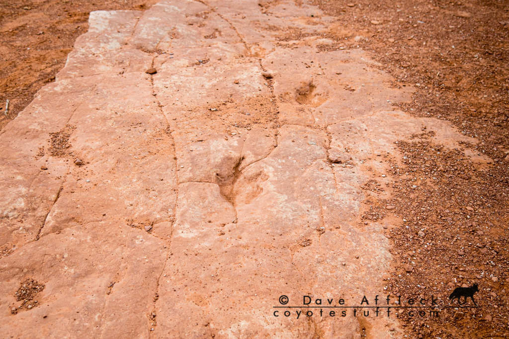
From there we hit the dinosaur trackway in Warner Valley.
From there we decided to head back into Arizona and pick up the Honeymoon trail as a possible route east over the Hurricane Cliffs. But, only a short distance into the trail we hit a carsonite that said it was closed. So we backed out of there and consulted the maps for another route.
It was at this point, it dawned on us that we were half way through our second day and had barely made any progress east towards the four corners. We decided that like it or not, we were going to have to do some significant pavement pounding to put ourselves in a position to reach our objective in the time we had.
So, we went into Hurricane for gas and headed out of town on 59. Not far from town a random dirt road beckoned and we got off the highway for awhile, ending up at what looked like an abandoned golf course project.
Then we got back on the highway in earnest. Taking pavement to Fredonia, Jacob Lake, along the Vermillion Cliffs, eventually connecting with 89 at Bitter Springs, then north to Page where we fueled up again.
It was getting late in the day so we tried a couple random dirt roads heading north out of Page and the second one provided a neat spot to camp for the night near Bishops Tank.
Day Three, Smoky Mountain And Burr Trail To Ticaboo
We got up and broke camp on day three, then consulted the map and 8 ball again to figure out where we were going to go. It was kind of a tossup between heading east across the Navajo reservation or taking a northerly route, but in the end we went north. Choosing to get off pavement quickly, we headed up the Smoky Mountain road.
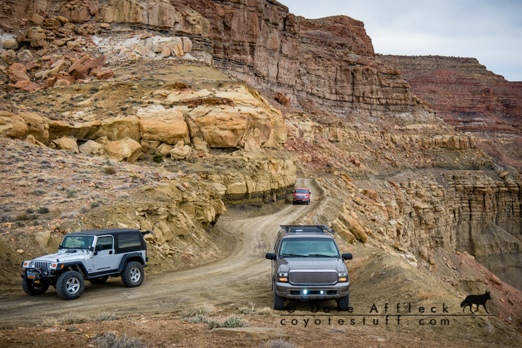
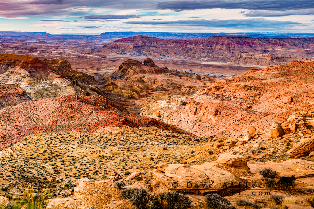
The Smoky Mountain drive was fantastic! But eventually, we found ourselves back on pavement again at Escalante. Consulting the map once more, we decided on super scenic highway 12 to Boulder, then take the Burr highway from there.
It was raining when we got to Muley Twist but we drove to the trail head and took the short hike to Strike Valley overlook anyway.


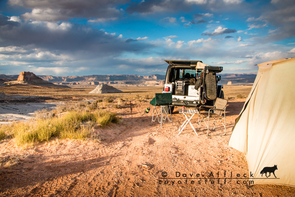
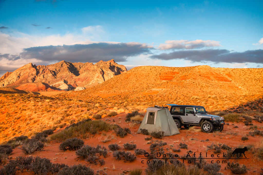
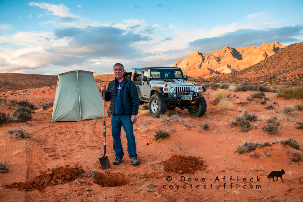
Then we headed south on Notom road to Bullfrog and started looking around for a spot to camp for the night. We ended up at a gorgeous spot at Ant Knolls.
Day Four, Valley Of The Gods, Four Corners, Montezuma Canyon
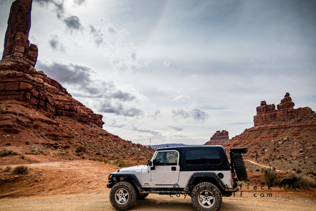
To start day four, we decided we were going to have to hit the pavement again. So we headed up to North Wash, across the river at Hite and over to Cedar Mesa, then down the Moki Dugway and back on dirt for a drive through Valley of the Gods.
From VoG, we hit Bluff and decided to beat feet on pavement for four corners. Taking the route from Bluff through Montezuma creek.
Upon arriving at the four corners, we all decided we didn’t need to get to the exact spot bad enough to pay $5 for a tourist trap, so we called it close enough at the entrance.

Montezuma Canyon
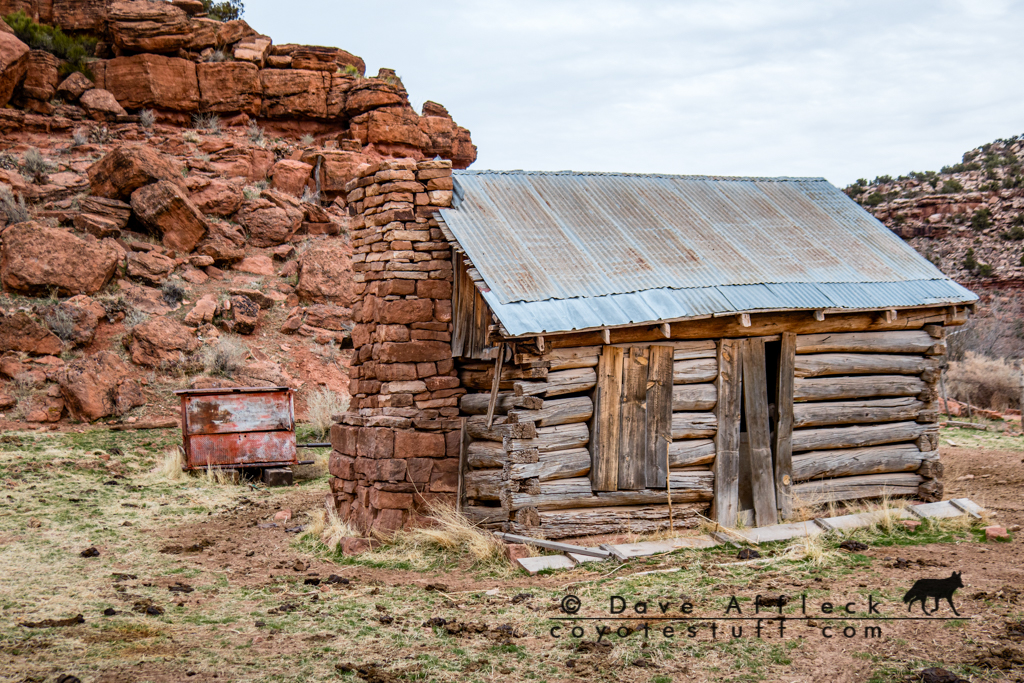
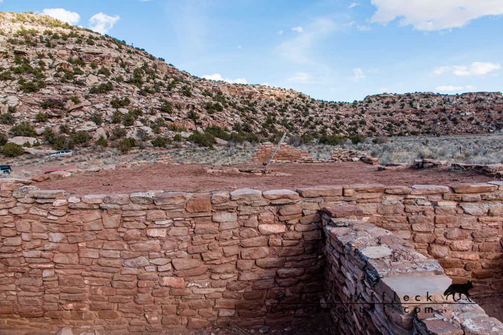
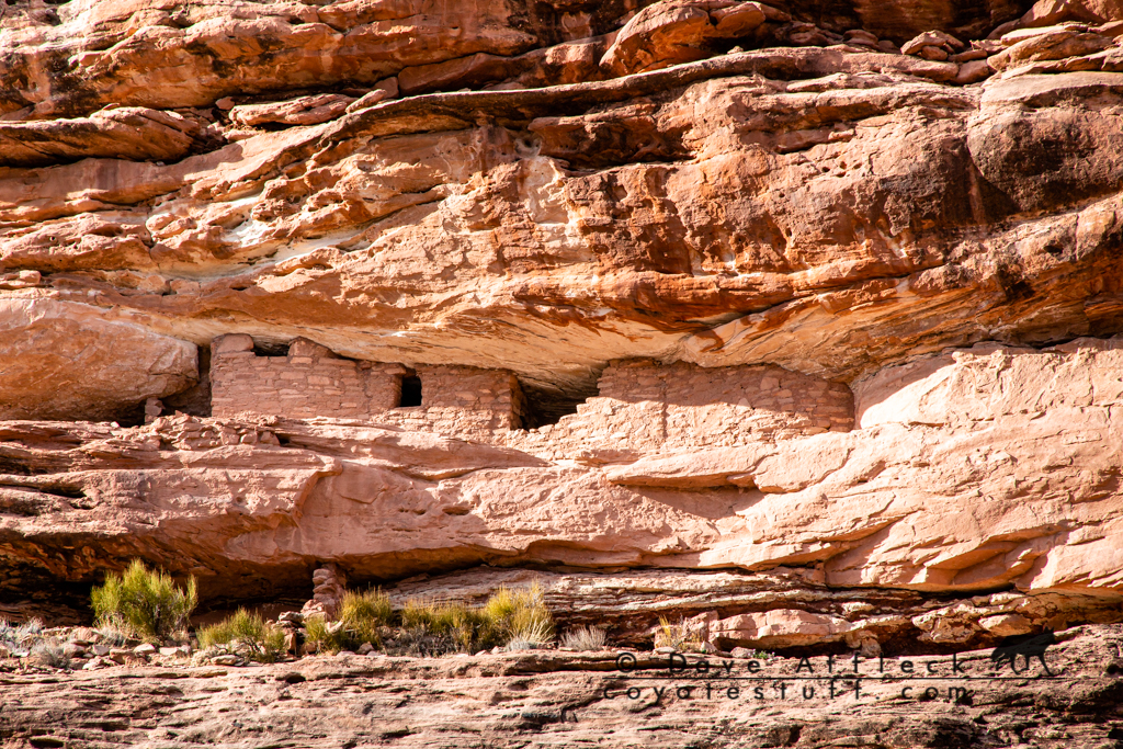
With plenty of daylight left in day four, we went looking for dirt from there. Deciding to head for Montezuma Canyon via dirt from Aneth, which took us close to the Cajon unit of Hovenweep so we stopped to take a look.
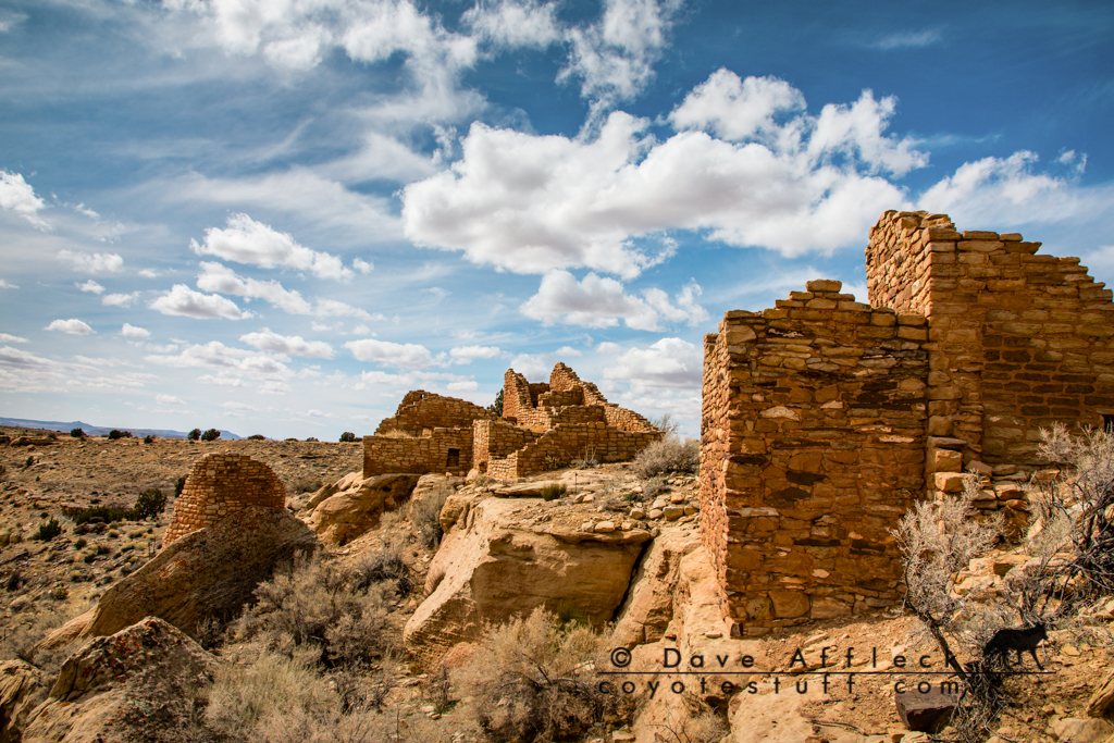
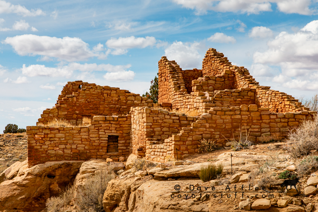
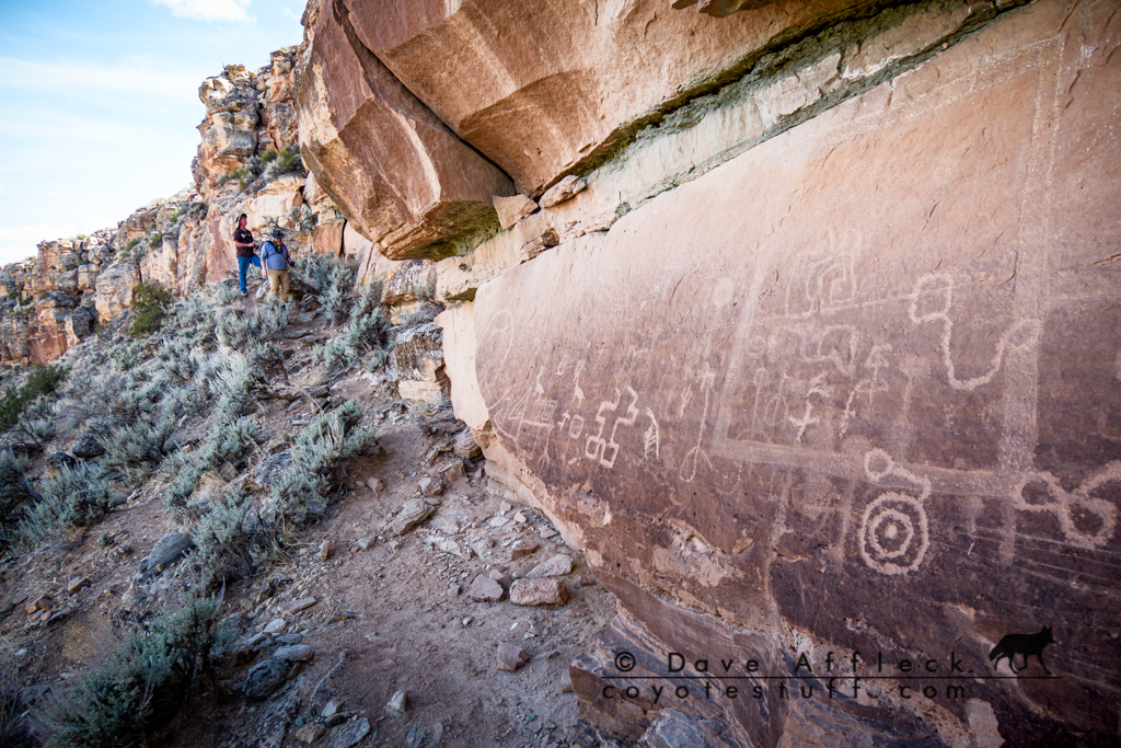
The route dumped us out at Hatch Trading Post, basically just across the road from more dirt in Montezuma Canyon, so up the canyon we went. Lots of cool stuff to see in Montezuma Canyon.

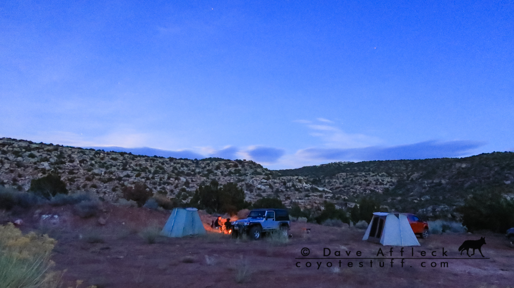
As the afternoon grew late, we chose another random side track and found a great camp site for the night.
Day Five, End Of The Dirt
The last day, all over except for the drive home… After breaking camp this last day, we continued up Montezuma Canyon until it dumped us out on the highway south of Monticello. From there, it was just another long boring pavement drive home and The End of a great trip!
Hey Dave,,,,, well, once again Dam Nice Write-Up and Photos,,,,, as usual, but that Overlook Photo, Dam,,,,, thats right out of a John Ford-John Wayne Western, I’ve got it as my Screen-Saver, as I’ve said before,,,,,, I like your Style.
BD in Alaska
Brad, that really is John Ford/John Wayne country for sure!
Dave,
Im happy I found your new website. I hope you are doing well? Glad to see you’re still getting out and exploring. I love the way you tell the story and your awesome pictures make it seem like the reader is there alongside. I’d like to chat with you on the phone about a gun project I’m starting, I want some of your expert advice! As long as you don’t mind anyway.
Hey Tanner, long time! I’ll shoot you an email with my number.
The history that those landmarks hold is amazing! I’ve been watching 1883 and I can’t imagine having to make those trips across the west and how hard it must have been and what people faced. The ruins and rock drawings you picture are so well preserved and you can only imagine the people that made them. What a great trip! Thank you
Thank you Regina!